Roads as empty as my head led me down into the valley of Annandale, barely a thought or car passing me by. Billowy clouds blustered overhead. Even the fields looked empty. The whispering of the thinning hedgerows gained a rumbling undercurrent as I eased into a parallel course with the A74(M), across the other side of the open dale. The small road on my side of the river undulated more than the roaring highway across to the left. I took my time. I would have to wait for Adam to arrive in Beattock anyway.
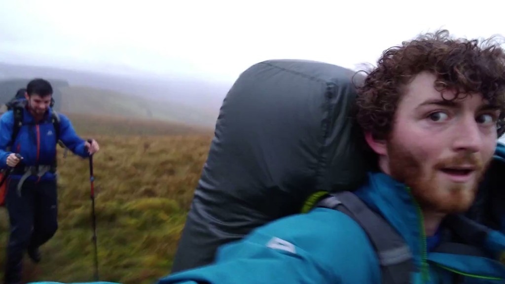
Adam is another of my former housemates from Bristol. We had been the two expeditions officers in the University of Bristol Expeditions Society in the same year – he had been far more organised than me. As part of that role, he had organised a glorious backpacking trip to the Lofoten Islands in Arctic Norway, that for me had started a love of all things Norwegian. He was also the first person I climbed outside with for the first time after my accident, two years later, and had been reassuringly patient as I struggled to control my panic and intrusive visions of myself falling again, on what should have been easy routes. He had set out that morning to drive up from his home in Sheffield. I had asked him to bring me fruit.
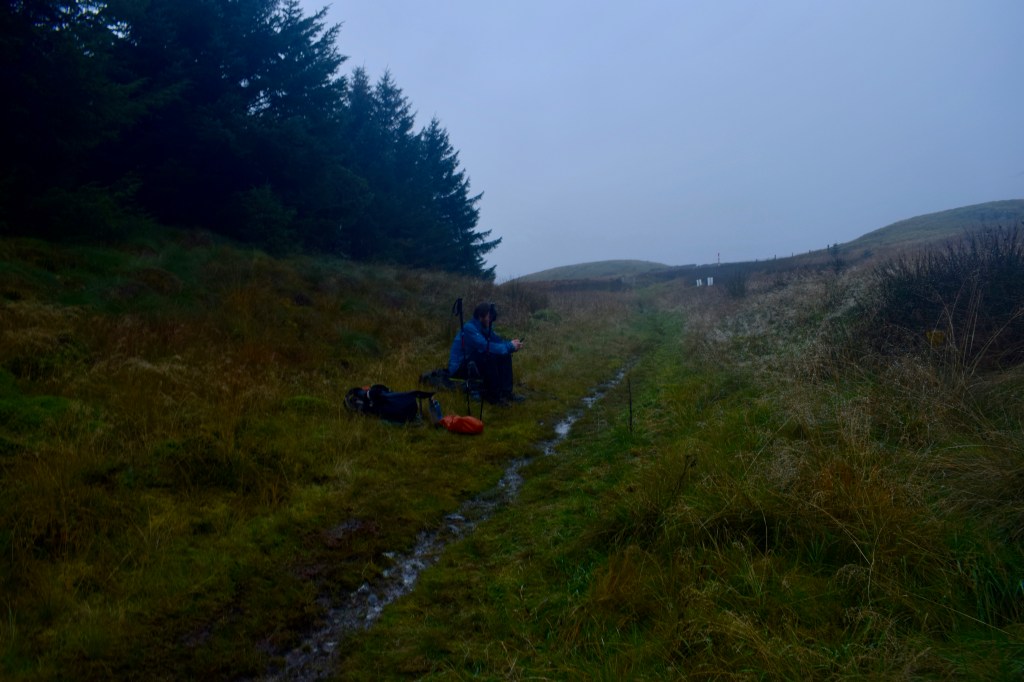
I turned to cross over the river, under the railway and motorway, and joined a cycle route into Beattock. As you might be able to tell, the 11km from the morning’s starting point were fairly unmemorable. I still had a while to wait, so I sat on a bench and read. By the time Adam arrived, we were both ready for lunch, so we wriggled with our big backpacks into the empty pub, and ordered some chips. I was pleased to find that Adam had come well stocked with snacks. After finishing and asking the lady at the bar to fill up our water bags, we found our way to a signpost marking where we could join the Southern Upland Way.
The Southern Upland Way is the longest of Scotland’s Great Trails, snaking across the widest part of the south from the Atlantic coast to the North Sea, over the top of the rolling Southern Uplands. Althought its overall direction is almost perpendicular to the way I was going, a meander in the trail meant that there was a section running roughly northwest from Beattock to the village of Wanlockhead, and in the absence of just about any other footpaths, I was eager to follow it.
The way took us up the west side of the valley, away from the farmland and into forest interrupted by clearings of heather. We went through a picnic area, but the weather was starting to turn, and we weren’t surprised not to find people there. Historically, this was reiver country. The frequent conflict between England and Scotland from the 13th to the beginning of the 17th century gave rise to a tough people who decided to make what living they could by raiding both sides of the border, using their knowledge of the hills to evade their enemies. They were seen as excellent cavalry, though they were difficult to control in an army, being mainly loyal to their own clan, and apparently seeing their fellow soldiers as potential sources of plunder, which I want to be true. The raiding began to calm down after the crowning of James I and the unification of England and Scotland, although with the way things are going, maybe they’ll be getting going again in a few years. Some border families spread and settled parts of Ireland and America, and the clan names live on. In 1969, a descendent of a reiver family by the name of Armstrong carried out possibly the most audacious raid of all, when he stole from the Moon.
Our feet were already squishing through the boggy ground when the rain began. Our clothes got wet from all sides as we sweated our way uphill. They were the kind of conditions that put a dampener on conversation, and Adam and I trudged with our heads bent over, watching our feet as water dripped down our brows. We went up and over Craig Hill, came down to cross a small burn, then began a steady slog of a few kilometres up to the highest point of the day. Towards the top of Mount Joe, we emerged suddenly from the forest and felt the free wind blast into us. Cresting the hill, a wide view opened up before us through the lashing rain and grey light. The two-mile long Daer Reservoir was below us. Beyond it, more hills in all directions.
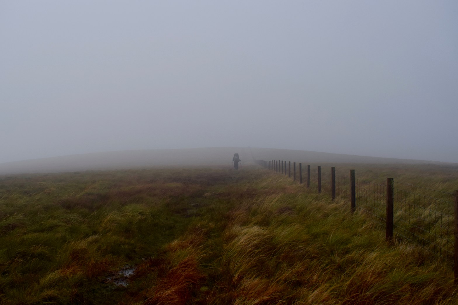
We turned to walk down to a saddle, following the edge of the forest to our right. We then had our last ascent of the day, a steep 100m up to Hods Hill (561m), for which we were helped along by the gale behind us pushing us onward. On the summit, though, we turned again to take the wind on the broadside. We leaned into it as we walked through a torrent of cloud and sideways rain. There were no features discernible but a lonely line of fence posts. No longer struggling with the ascent, I was able to revel in the meteorological dramatics. After all, I was already wet. Adam had hung back to get out his camera, and I was glad I would be able to show people the conditions we were marching through. In fact, I was glad of the conditions in general – I would have felt a little let down if the whole walk had failed to throw something like this at me.
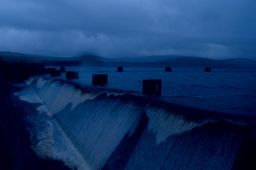
The amount of light managing to fight its way through the thick cloud was diminishing as we descended a long spur towards the reservoir’s dam. As we approached, we could hear a great rush of waves. We arrived at the point where countless gallons of water are allowed to slosh out of the reservoir into a channel running under the bridge we were standing on. We watched it for a wile before striking along the dead straight line of the dam itself, the wide reservoir to our left, and an uncannily steep, grassy slope dropping away to our right. There was something deceptive about the dam, and it took far longer to cross than we expected. In fact it is half a mile long, but we hadn’t got our heads round that. It got dark while we were still crossing, and we got our headtorches out.
We decided to look for somewhere to camp on the other side. A service road curved round the base of a forested hill. To our left was a sloping area clear of trees, and we dropped our bags to examine it – it was almost entirely rutted up, and it took us a while to find anywhere that was even close to being flat enough for my tent. Everything was wet, and that awareness had become much more unpleasant once we stopped moving. Adam is about the same height as me too, and everything became a bit of a damp squeeze inside the tent. The rain didn’t stop, but eased a little, and I took the opportunity to cook as quickly as possible. I was less appreciative of the weather at this point, but it was all part of it. I resigned myself to the fact that, this being Scotland, this might be what I had to expect from now on. Oh well.

You find the most amazing facts. I never knew that about Neil Armstrong.
LikeLiked by 1 person