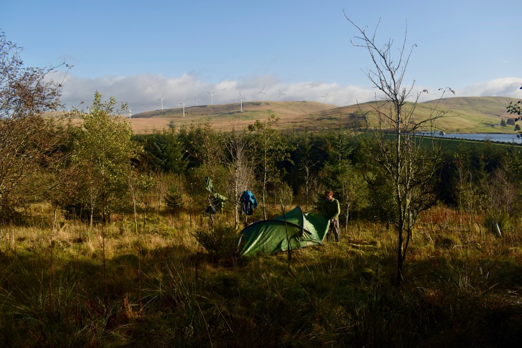
The battering of wind and rain against the thin walls of my tent meant that sleep had come fitfully, but the morning was miraculous. I emerged into glittering surroundings. The sky was clear, the sun was out, and prospects were looking up. I peeled out the dampest of my gear and began to decorate the surrounding birch saplings with it. Adam joined me in this. We had distance to cover, but thought it would be worth allowing ourselves a bit of drying time. Even the tent, once we had emptied it, got a place in the sun.
We first followed a track through the forest before emerging into the open, wet grassland of the Daer valley. We came across a couple of archaeological sites – a seventeenth century bastle house and a burnt mound. As I remember, there was a bit more to look at in the case of the former, though the fact that I didn’t take a picture of either implies neither was drawing in the crowds. Bastle houses were built like mini fortresses to protect the local farmers from the marauding reivers (not that the occupants would necessarily object to a spot of reiving themselves). Whereas most houses in the area would have been built of turf or clay, these had stone and mortar walls three feet thick. The burnt mound was indistinguishable from the surrounding ground but for a sign saying “BURNT MOUND”. This was a site where bronze age people heated water with hot stones, potentially for bathing or even saunas, depending on how willing you are to go along with the wild conjecture that is an archaeologist’s bread and butter.

After advancing a bit further, we encountered a strange thing. It was another backpacker, walking the other way. I was definitely surprised; I had become so used to being the only one around. We stopped for a chat. The man was drenched in sweat. “You’ve got quite a climb ahead of you,” he told us with a grin and an Eastern European accent. We looked at the high, rolling hills behind him. “Does the path go up there?” we asked. “Yeah, it’s pretty steep.”
When we’d wished each other luck, I got up my map and examined it more closely than I had previously done. When planning the route, I simply assumed that this well-used long-distance trail would be the path of least resistance through the hills, probably winding through the passes. This was not the case. The way went up onto the summits of several hills, just about maximising the possible ascent. Well ok then.
We came out into the glacially carved Dalveen pass and walked southwest along the A702 for a kilometre or so before beginning the slog up Laght Hill, 200m above the valley floor. We then immediately went down 100m to a col, then up another 220m to Comb Head and Cold Moss. We had left all trees far behind and were in a world of windswept, empty hillsides. As we climbed and could see further around us, a sense of vast emptiness took hold. The only notable feature of the landscape was the dozens and dozens of wind turbines covering the surrounding hills. Ecologically, the barrenness of the land didn’t sit well with me. I didn’t know its history, but I felt certain there should be more life and diversity here than we were seeing.
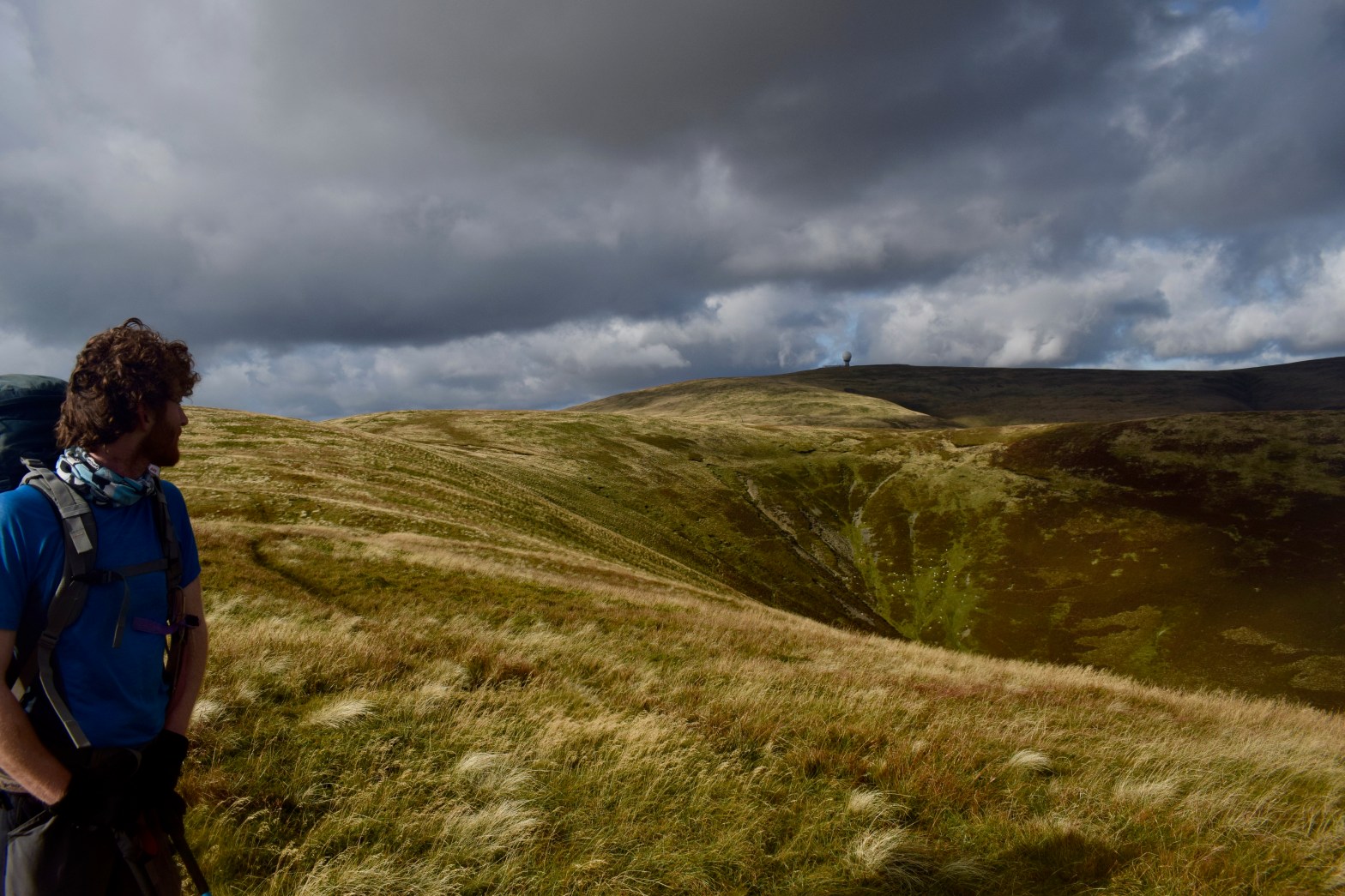
The chill wind whipped away my excess body heat as the strain of the ascent generated it, and I found the best combination of clothes to be a thin baselayer t-shirt accompanied by gloves and a buff. It also snatched away any words from our mouths, so we pushed up the final ascent to Lowther Hill (725m) in determined silence. The path actually skirted just beneath the summit, which instead was occupied by the slightly bizarre structure of Lowther Radar Station. We had first spotted this from far off, sitting on top of the hill, looking exactly like a giant golf ball, teed up and ready for a titan to take a swing at. The white sphere is actually just there to protect the inner machinery and instrumentation from the elements, and the purpose of the station is to monitor air traffic. This was the highest point I reached between Scafell Pike and Ben Nevis.
It was then steadily downhill for the next couple of kilometres, down to Wanlockhead, an old mining village, and Scotland’s highest, at around 410m above sea level. The name is derived from the Gaelic “Cuingealach”, meaning “the narrow pass”. This little village has a long history. The Romans were the first to exploit the lead deposits here. For centuries, lead and other minerals were mined in the summer months, with the high, inaccessible valley being abandoned in the winter. Eventually a permanent lead smelting plant and housing were established in the 17th century. The richness of the deposits led to the place becoming known as “God’s treasure house”. There was zinc, copper, silver, and gold of such high purity that it was used to make the Scottish Crown. Mining ended in the 1950s once all of God’s treasure had been carried off.
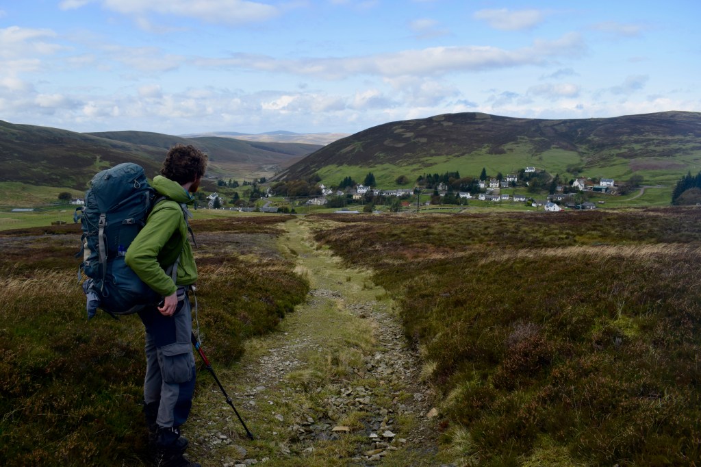
Old mining towns sometimes have a feeling of having been left to wither away, but Wanlockhead appeared to be prospering fairly well. The Museum of Lead Mining is found in the heart of the village, and Adam and I were intrigued by the words “Beam Engine” marked on the map – to me it sounded tantalisingly steampunky. The fact that the Southern Upland Way goes through the village also helps bring in the tourists. Admittedly, when we arrived, it was very quiet. We bumped into a couple of ladies, who put a donation in my pot. We tried to check out the museum, but it was shut, so we settled on the pub instead. On the way there, we were passed by the same ladies again in their car, and one of them went and rummaged around in the back before handing me a carrier bag full of loose but individually wrapped tea biscuits. Munching on these perked me up for the next several days.
Scotland’s highest pub is a good one, and we enjoyed (predictably) chips and a drink, and recovered a bit from our march over the hills. We left the village to the north, along one of the three valleys that Wanlockhead sits at the confluence of. A couple of kilometres brought us to the next village of Leadhills, which you can work out the etymology of for yourself. It’s a credit to the self-improving attitudes of the 18th century miners that these two tiny villages have the two oldest subscription libraries in the British Isles. As we passed through the village, many windows were adorned with signs proclaiming a desire for No More Windfarms, and that we must Save The Lowther Hills. As I had thought the Lowther Hills looked like something of a wasteland in terms of biodiversity, I wasn’t completely sure what they wanted to save. Restore The Lowther Hills, or Rewild The Lowther Hills would be slogans I might find it easier to get behind.
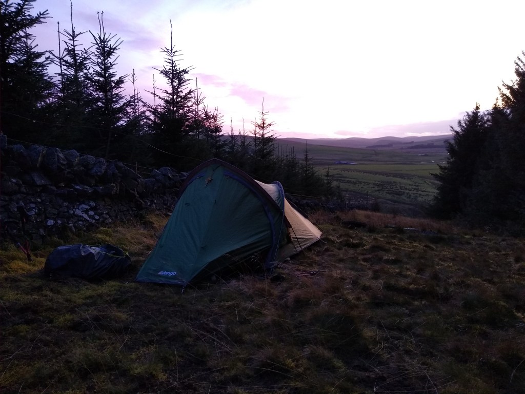
The sun joined us as we covered several more kilometres down the valley, fairly worn out. We followed a side road that cut over the hills, thankfully at their lowest point, towards the village of Crawfordjohn. The hill to our right was covered in dense sitka plantations, and since the way ahead looked a lot more open, I thought we should keep an eye out for a sheltered spot to camp. Eventually we explored a narrow strip between the forest and a wall on a terraced hillside. The sun was sinking low and the wind was still whipping right through us, but after getting the tent up, I found that under the trees it was still, quiet, and there was a comfortable, uninterrupted, smooth carpet of needles blanketing the ground, so we sat in there to cook and eat. We enjoyed the calm as the sky outside faded from pink to grey. After facing all that ascent, we hadn’t covered quite as much distance as I had hoped, losing ground against my plan. I was always thinking of the effect this would have on the days ahead. We were 75km from Glasgow, and I hoped to get there for the night after next. It looked like there was an unpleasant experience looming in my immediate future.