
I made sure we were up and away as the dawnlight was only just beginning to rise. Soon after rejoining the West Highland Way, we saw a large, still shape in the heather. We stalked closer through the gloom, and it resolved into a doe (a deer; a female deer; Cervus elaphus). We were only a few yards away when she spooked into life and fled.
We gradually climbed for a mile or so. To our left was the unpronounceable Meall a’ Bhùiridh, one of the handful of mountains in the area with optimistic ski lifts on its northern slopes. We were climbing to the col between the mountain and the lower hill of Beinn Chaorach. Morning had come by the time we rounded the top, and we could see down to where the A82 carved a straight line across the misty expanse of Rannoch Moor. We curved round to the north-west, and began gently to descend again.
Although after today, I would still have the UK’s highest mountain to climb, this felt like a culmination; the last, longest leg of the journey. I had been deteriorating for two weeks. I was starting the day in that stage where the fuel gauge is pointing to empty and you don’t know when you will be forced to stop. Con’s feet were troubling him too, so it was with a certain grimness in our resolve that we approached the mouth of Glen Coe. This was a big, open landscape where everything we could see took slightly, dishearteningly longer to reach than we expected.
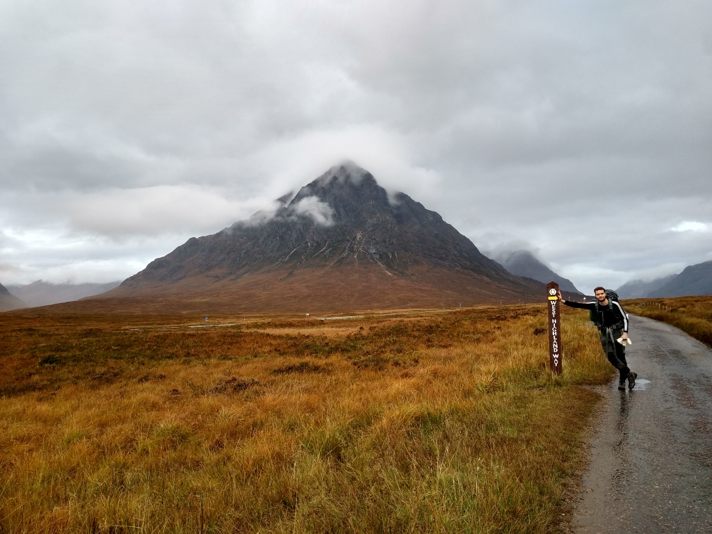
Cloud blanketed the sky, and the landscape’s palette was dun. Nonetheless, the approach to the glen was as magnificent as ever. Buachaille Etive Mòr keeps a brooding watch over the entrance. Seen from the east, it appears as a great, rocky triangle, with climbing and scrambling routes on its north-eastern ridges which are not for the faint of heart or unsteady of step. This was the fifth time I had journeyed to Glen Coe from the south. Not only was it the first time I had approached on foot, it was also the first time in daylight. Previously the mountains had either shone in the moonlight under a starry sky, or appeared only as giant black shapes, deeper than the encompassing blackness.
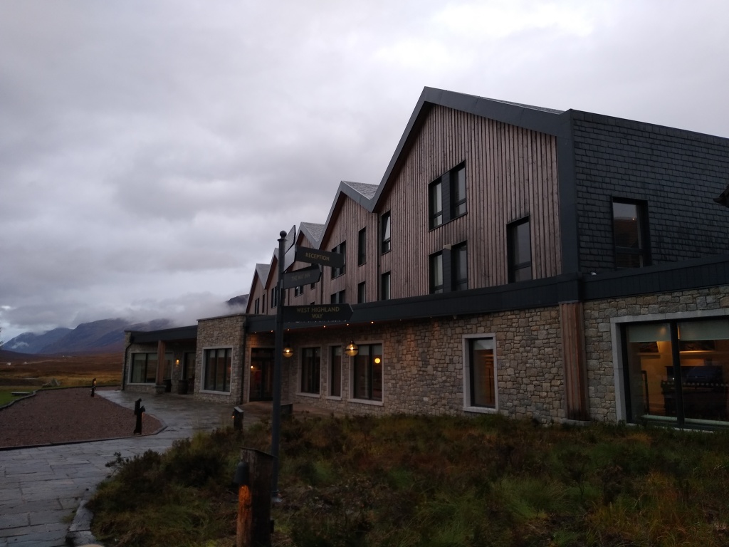
We stopped outside the Kings House Hotel, where Con bought a coffee. As we rested, a gaggling guided group of American tourists came out in a whirl of brightly coloured hiking gear and chatter, chirpily excited for their highland experience. Con made some small talk with them – he’s better at that than me. They set off in the same direction as we were heading before Con finished his coffee, which gave us a good little spur; they were a well-aged bunch and even in our state, we weren’t going to let them go faster than us.
We were also encouraged by a lapse of memory on my part. I had been telling Con about how great the Clachaig Inn is, with its stone and wood hikers’ bar serving good food and drink, decorated with mountaineering equipment from ages past (I am not sponsored by them, but I wouldn’t say no). I set my eyes on a clump of trees where I thought it was. Sadly my memory had failed me; it actually lies at the other end of Glen Coe. It probably wasn’t worth a detour on foot.
The mountains closed around us as we entered the glen (although here it looked more like a strath, if you ask me). Rather than following it, we turned up the side of the glen, to climb over its northern mountain wall via the Devil’s Staircase. It’s an ominous name, and it does zigzag up to the highest point on the West Highland Way at 550m, but this was the section I had walked nearly three years before, while still on crutches, less than three months after my accident, so it can’t be that bad. Apparently workers from Kinlochleven would sometimes fail to find their way home from the pub along the steep path, and folk would say they had been claimed by the devil.

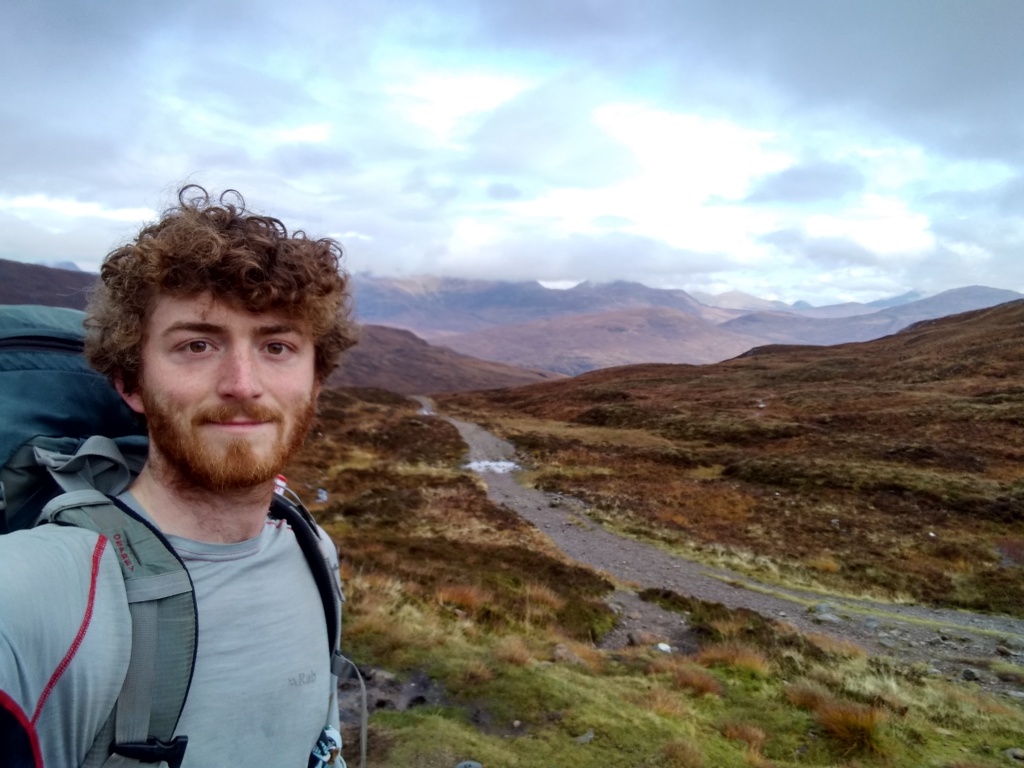
As we trudged slowly upwards, I took out my phone to film a little bit of it. As soon as I lifted my arm up, I could smell myself. With the odd breather, we crept back and forth until we reached the saddle, and could see the stony path twisting off ahead towards the Mamores mountain range, the final great barrier between me and Ben Nevis. There was not a building in sight, until we advanced far enough to see the Blackwater Reservoir away to the right. We ambled along fairly happily, though Con was saying he would probably not make it to Glen Nevis. I was reluctant to leave him behind, but it was becoming increasingly clear that he was suffering. When we rounded a spur and could see the wooded valley winding down towards Kinlochleven, we sat down for a break. Con worked out that he could catch a bus from the village to Fort William, and escape by train, and so the plan was settled. We were passed by a few other walkers while we rested, including a very friendly couple from Oregon coming the other way. They were wildly enthusiastic about the beauty of the highlands. I haven’t been to the States, and I asked them what Oregon was like. “Pretty similar to this really,” was the reply.
Though going uphill may be tiring, descent is harder on weary feet. Coming down took far longer than I remembered. “Where the hell is this village?” exclaimed Con at one point. When we finally limped to the valley floor, it was no surprise that we made straight for the Tailrace Inn. It was empty when we arrived, and we ordered macaroni cheese and chatted to the barman. He had grown up in the little village, tucked away at the end of its own valley, on the tip of Loch Leven. When he had been a lad, everyone had worked in the hydroelectrically-powered aluminium smelter. In fact, the whole place was powered by the hydroelectric works, and Kinlochleven claims to be the first village in the world where every house had electricity. The smelter closed in 2000, however, and the village folk have been trying to establish a future for the area. There is plenty of tourism in the summer months, but apparently in the winter, it is a ghost town. One reason to visit, though, I can attest, is the excellent macaroni cheese.
While we ate, a group of four young hikers came in, and we struck up conversation. They had met each other along the way and started walking together – they were from Poland, Czechia, Germany, and Australia. The German woman told us how she had travelled here specifically to walk the Way. I asked her about long-distance footpaths in Germany and she said there weren’t as many and they weren’t as good. They all expressed admiration for the British hiking culture. I felt a soft glow of pride in my country, rare in that it wasn’t tainted by some dark undertone. I usually feel that a lot of the achievements we are supposed to take national pride in are built on the foundations of imperialism and industrialism, and a lot of our heroes weren’t great eggs when you dig down into it, but this was something else. We love hiking. How pure, how precious.
We had walked 20km that day, which I would say is a decent longish hike for an ordinary day, and after I had finished eating and resting, it was getting on for mid-afternoon. The hikers were staying there for the night, apart from the Australian woman, who was winding scraps of sheep’s wool round her toes to stave off blisters before setting off. I looked at the route. With my rough knowledge of the geography of the area, I knew that Glen Nevis was the next valley over. I didn’t want to believe what my phone was incontrovertibly telling me though, that in order to reach my end point for the day, I would have to do the same distance again.
The problem was, as I mentioned before, there was a mountain range in my way. Some of the Mamores are over 1000m high, and to cross them directly at a saddle would involve going steeply up above 800m. The West Highland Way skirts widely round them through Lairigmor – The Great Pass.

Con saw me off for my last push. He was off to spend a romantic weekend with his wife, and I couldn’t blame him. The path climbs 250m up the side of the valley, straight out of the village, to enter into the pass. Fortunately, the afternoon had brightened up, and there were fine views through the leafy woods across Loch Leven and towards the Pap of Glencoe. I admired them even as I huffed and groaned and blew air through my lips. I moved slowly, achingly, leaning on my poles to drive myself upwards. Finally I levelled out and the mountain walls on either side stretched ahead, forming a wide, brown valley. The only features were the track and the river, going on and on, deep into the mountains.
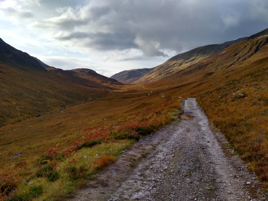
Fairly early on, I passed a nice lady who was going to spend the night in Kinlochleven, and a sheep farmer drove past at one point, but after that, there was nobody. West I went for several kilometres, all the same, all the way along. I eyed up the mountains to my right, wondering how hard it would be to cut over a saddle, but there were no shortcuts to be had. Eventually the valley curved right, round the western end of the Mamores. I passed through an area of largely clear-felled forest that had been planted up one side of the valley.
As the light took on a late afternoon hue, I came across a large cairn, and a sign that told how the defeated Campbells had fled this way after the Battle of Inverlochy, with the MacDonalds chasing them down. The cairn marked where the pursuers gave up and turned back. Supporters of the MacDonalds are supposed to add a stone to the cairn, while Campbell fans are advised to take one away. I abstained.
After who knows how far, I came to an information board with a little roof over it, and a flat bit of concrete to sit on. The sky was clouded over again, the light was beginning to fade, and the temperature was dropping. I set up my stove and checked my phone. Zoë was on her way north with her dad, Steve, and we had been updating each other on our progress, but here there was no signal. I was truly alone. I put on my layers as it began to drizzle, and ate the last of my cous cous packets, and just about anything else I had left. Then I packed up my bag for the last time.
I trudged into the night. The rain got harder and the darkness pressed in. I could no longer tell how far along on the path I was – I could only illuminate my immediate surroundings, and I couldn’t get GPS on my phone. All I knew was that I was going up and down, and getting wet. My surprisingly handy little umbrella had dropped off the side of my bag by Loch Lomond. I thought that after going up for a while, I must have come to the edge of the pass, but instead, the path took me on and on. It felt endless, but I knew there would be light at the end of it. I had vaguely thought of camping in Glen Nevis, but that was long-abandoned. I would slump into the hostel, and wait, and see Zoë, and then have a bed.
At last, I emerged to see dark, open sky above me, lights below, and a great blackness across the valley. A forestry track opened into a clearing around me. I checked my phone and found I had signal again. Zoë was in Scotland, and I was 3.5km from the hostel. She booked me a bed and told me I was doing so well. It was with a slight extra spring in my hobble that I made my way downwards along the track. Finally, the worst really was behind me. An hour later, at 9:30pm, I reached the hostel. I was soaked and could barely function, but they were expecting me. They showed me around, and somehow I found the energy not to collapse immediately but to shower, change my clothes, and put a wash on. Then I sank deep into a chair in the lobby and waited.
When Zoë came in, I hugged her tightly, and Steve gave me a warm handshake. “See you on Ben Nevis in two weeks,” he had said, the last time I had seen him, back in Keswick. Here I was. I had done it. There was one more thing to sort out, though, before I could sleep. We had to make a plan for tomorrow. Ben Nevis is not like Snowdon. Snowdon is in some ways a perfect hikers’ mountain. The summit can be approached by a path following a ridgeline from almost any direction, and you can reach the top by anything from an invigorating but straightforward walk, to a tricky climb (or by sitting on a train). You could even start on one side, come down the other, and easily get a bus back. Ben Nevis is not like that. It is a great, dark hulk, hunched over to present only its steep but rounded shoulder to the world. There is only one path to the summit, and only two places to approach from the bottom, really: Glen Nevis to the west and the valley to the north-west. To the east lies a range of subservient mountains for miles and miles. Its north face, folded in on itself, is a climber’s playground with dozens upon dozens of routes up via gullies, ridges, and faces. The casual walker, though, has little choice but to slog up the long, zigzagging path, reach the top, enjoy the view of the permanent cloud that is there, and then go back the same way.
Even after walking across three countries for a month, this was too dull a prospect for me to contemplate, so Steve, Zoë, and I agreed to go the other way. Across from the north face of the Ben is a ridge with three peaks, each with their own name. These form a continuous horseshoe with the Ben, joined to it by a long, narrow ridge, known as the CMD (Càrn Mòr Dearg) arête. The walk/scramble along this is not technically challenging, but it is reasonably long, committing, and exposed in places, and is much more interesting and exciting than the path. That was where we would go. And with that settled, I said a heartfelt goodnight, went to my dorm, and slept the sleep of the dead.
