Day 22: The Falls of Clyde

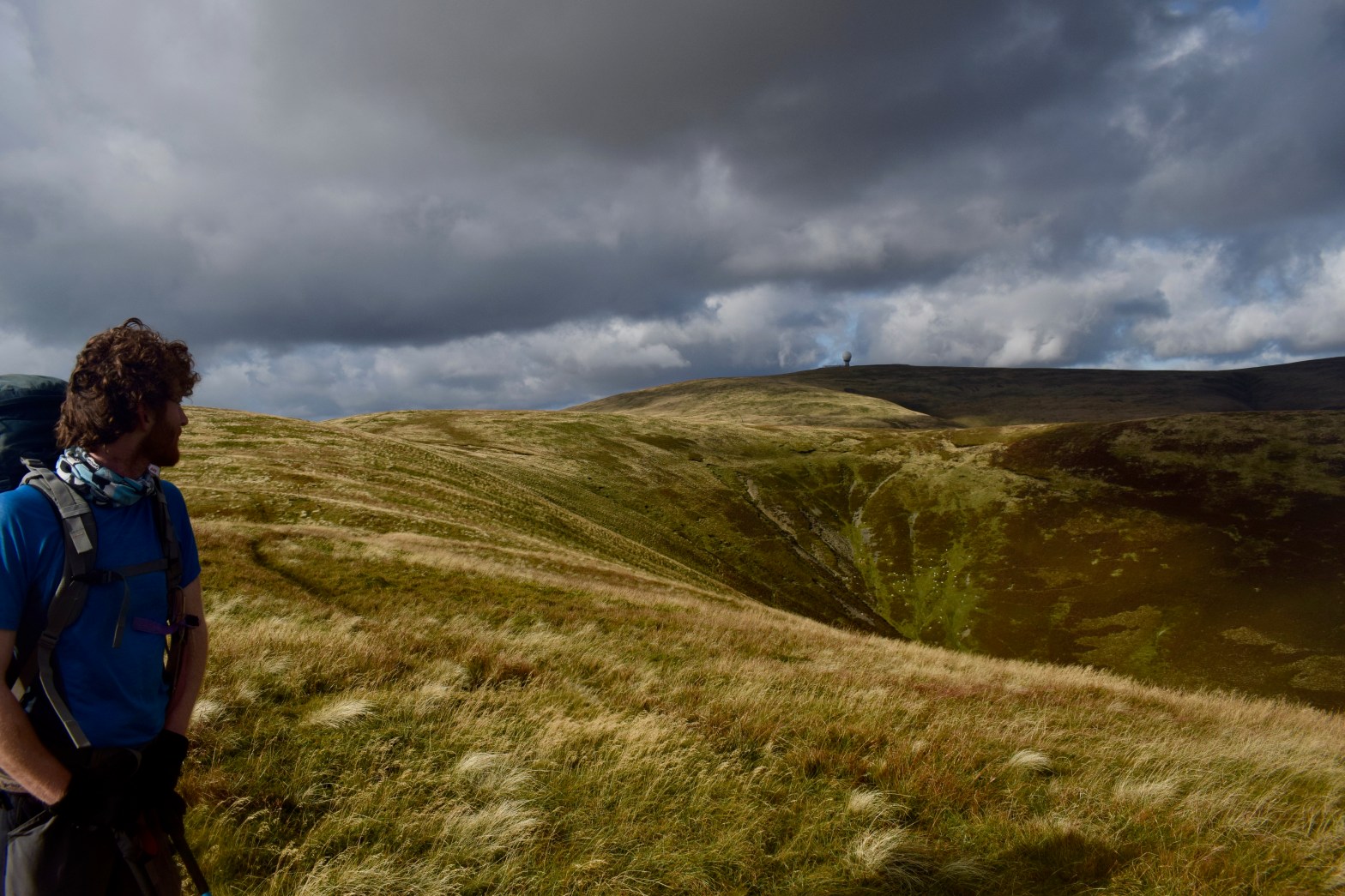
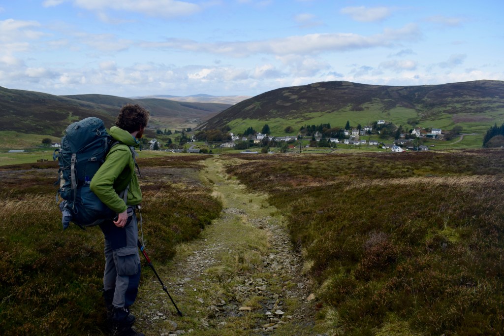
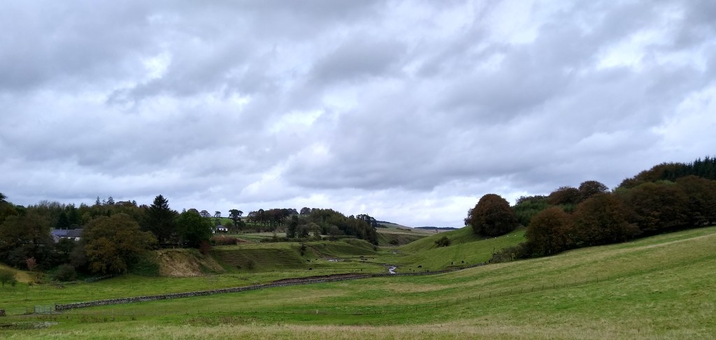
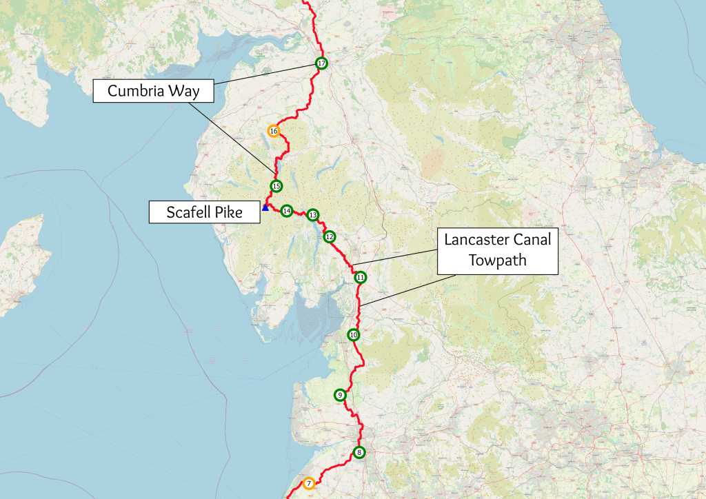
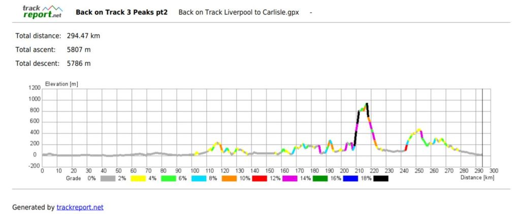
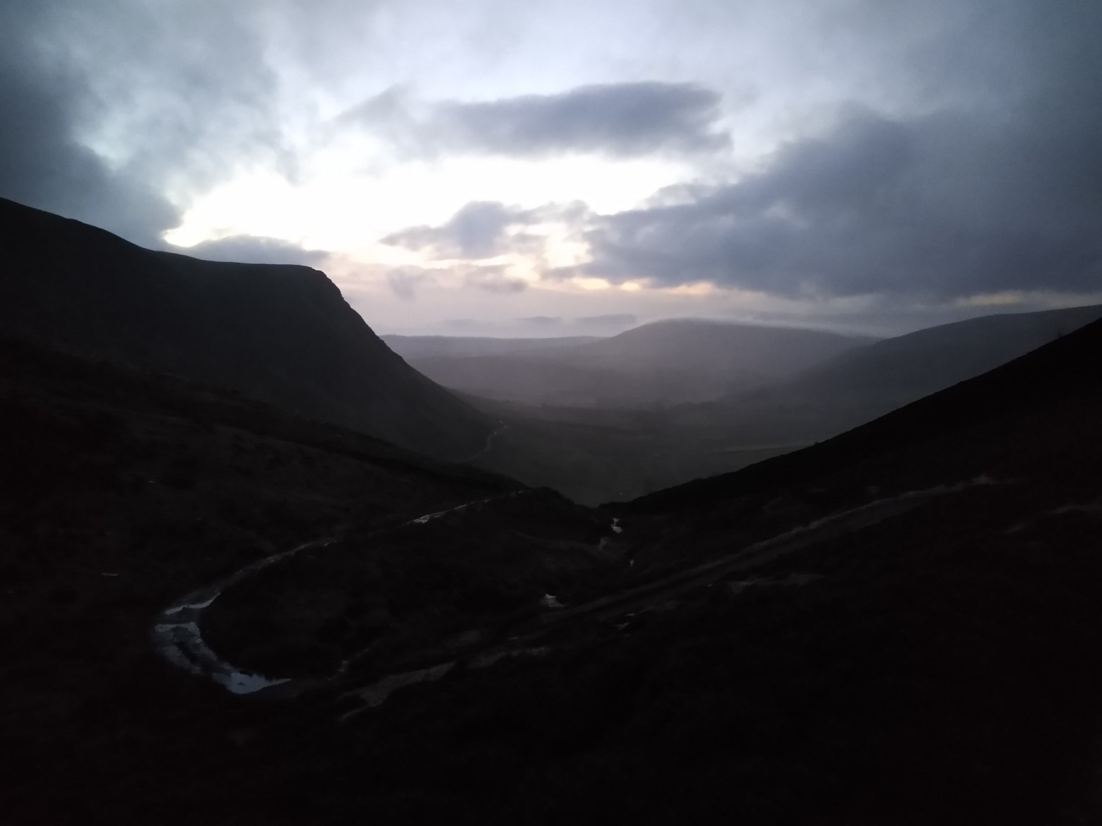
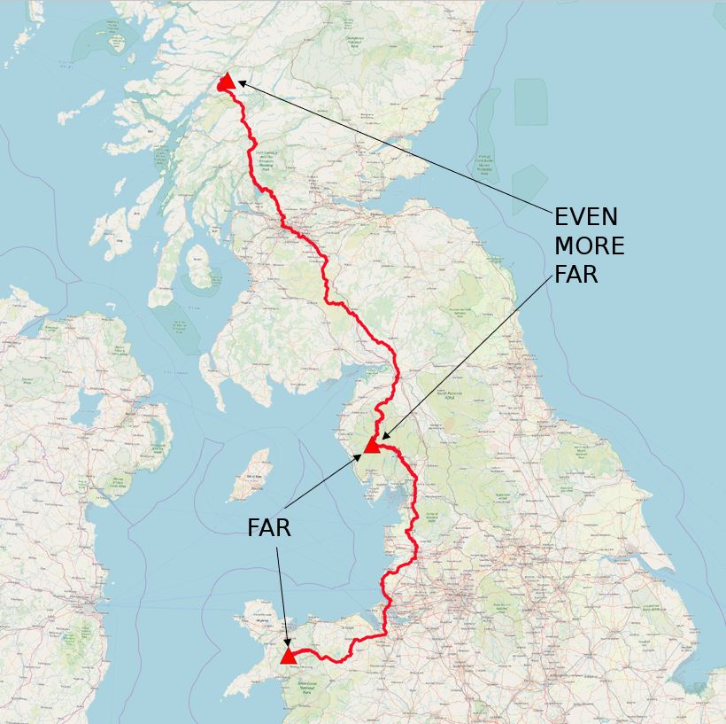
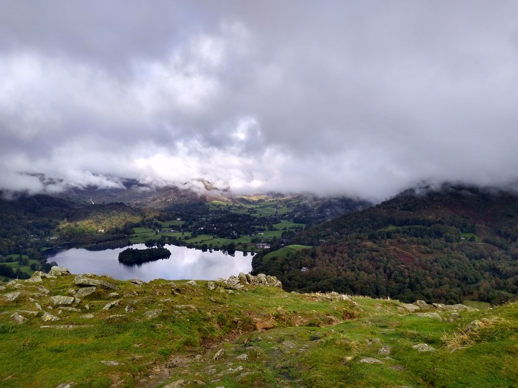
There is apparently an old phrase that goes: “Out of the world and into Crawfordjohn.” This was the first thing we did, coming off the hill, down to the floor of the Duneaton valley, over the river and into the village. The village is tiny, however, so very shortly afterwards, we were going out of Crawfordjohn and into the world. The world we were going into, however, seemed an empty one. The hills were lower, and the land was smoothing out with very little to see. Over the next couple of kilometres, we only passed a sheep farm or two, before joining the cycle route along the side of the B7078.

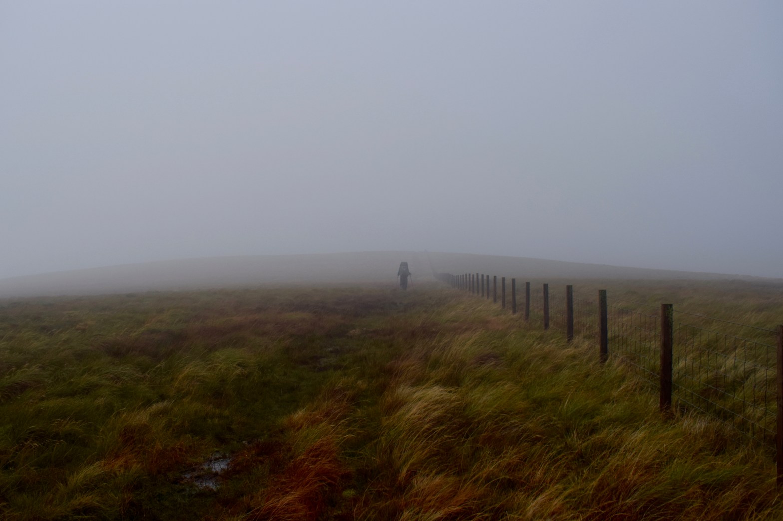
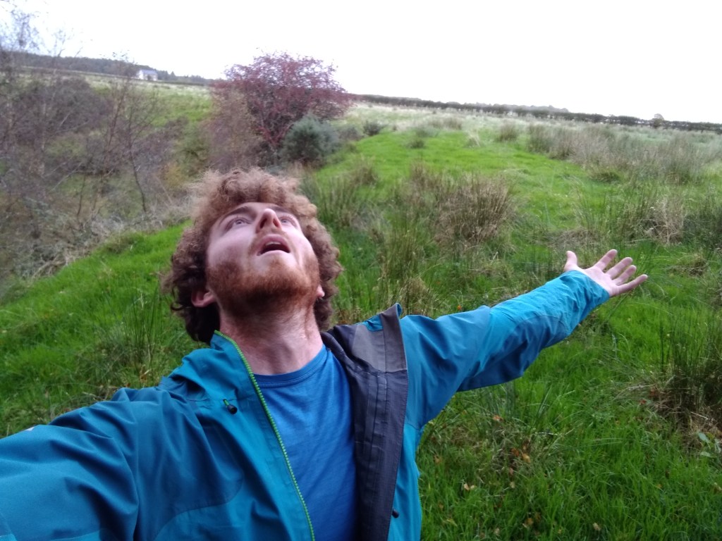
This was a road with its glory days behind it. Previously the A74, this was an important north-south highway until the M74 superseded it, and it was demoted to a strangely wide but empty B-road. The motorway was running parallel to us less than a kilometre away, hidden above a rise. The road stretched out before us, a thin screen of conifers on one side, empty brown land on the other. This felt like a nowhere-place, a blank distance to be passed through as quickly as possible. That was what the rumbling traffic away to our right was doing, and that was what we would do too. We marched.

We followed that road for nine empty kilometres – an incredible distance to have so little in it. Imagine planning a 9km walk with family or friends. If you picked the right area, you could easily enjoy a forest, a viewpoint, a historic site, a river, and a nice pub. Now imagine replacing every entertaining part of that with an almost featureless landscape and mounting foot pain as you pound the tarmac thousands of times. The Red Moss Truck Stop stood out by virtue of being the only thing there. While I’m sure it provides a decent service, its loneliness gave it a post-apocalyptic vibe. We saw vehicles lined up but no sign of any life.

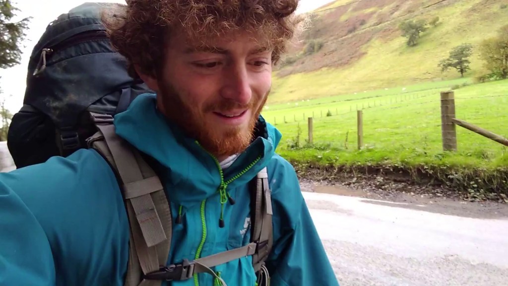
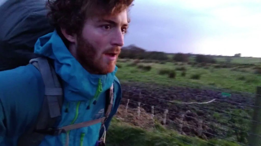
At least we had the tea biscuits we’d been given the day before. We stopped a couple of times for quick breaks but made good time overall. The road curved round very gradually for 3km to squeeze up next to the motorway, where the landscape funnelled both between two hills. A few more kilometres, and we passed under the motorway and made our way up to Happendon services to refill our water. The sudden mass of people around us was jarring, and I was very aware of how out-of-place I must look, and probably smell. Water was provided in glass jugs on a side table in the cafeteria. I emptied one into my bottles, and Adam did the same, which felt very wrong. I couldn’t help browsing the trappings of civilisation, or the weird imitation of it that exists in service stations, for a while, but I made no purchases. We didn’t want to move on straight away. We wanted to rest. I propped my big, inelegant rucksack by the wall and charged my phone for a while, compulsively seeing how far we had come, how far we had to go.

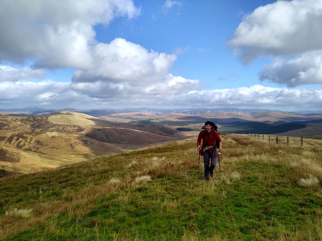
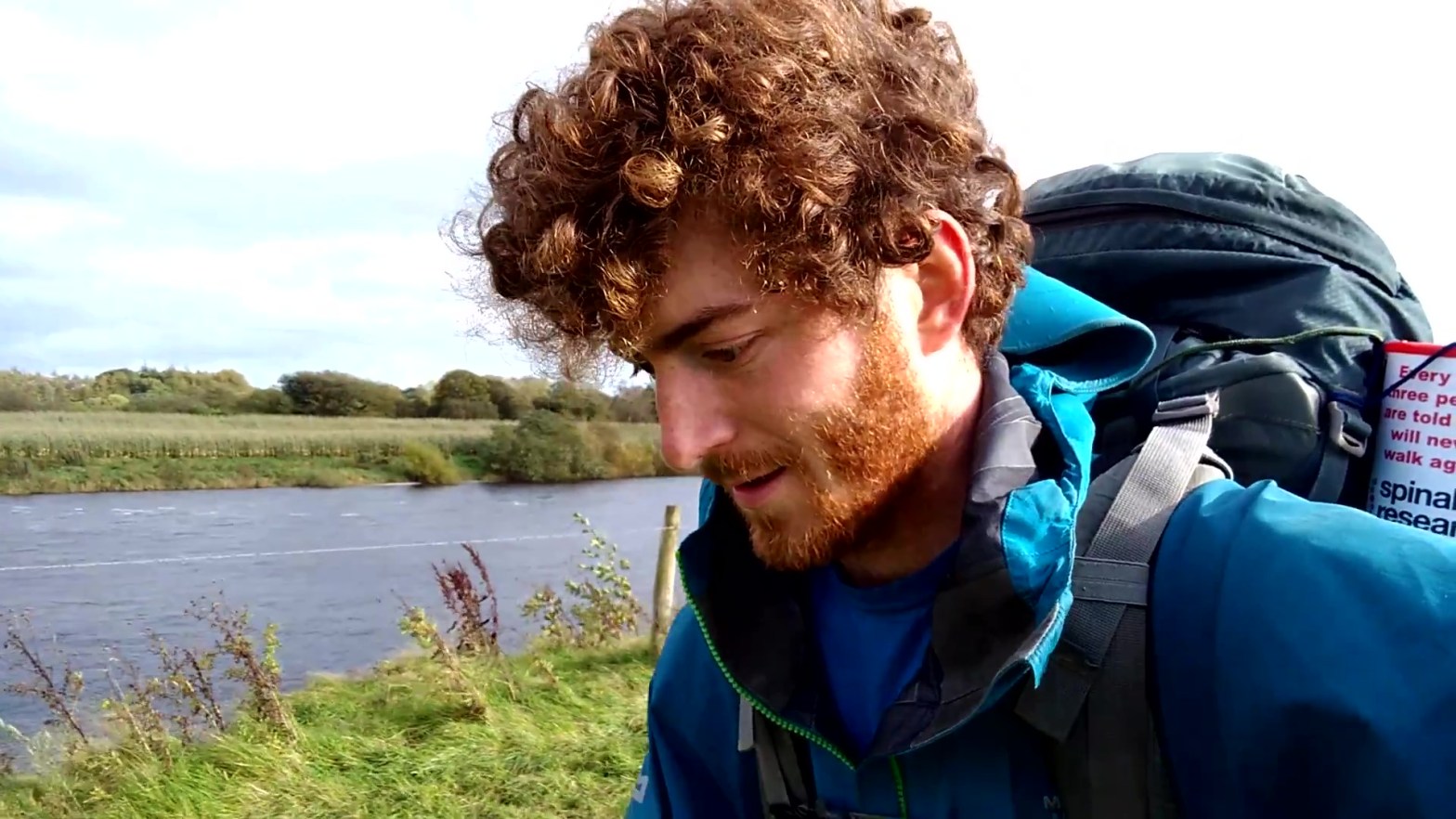
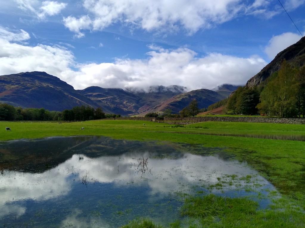
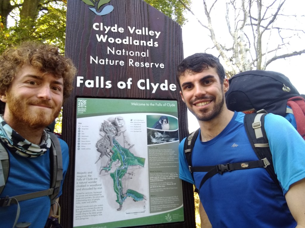
Eventually we forced ourselves on, along a quiet but much less dystopian-feeling road through some farmland. Things were greener and felt more full of life up here, and the sun was out. I knew we were drawing close to the Clyde. I had set this up in my mind as a big moment, because it meant the end of the kind of wandering I had been doing since leaving Carlise and for a lot of the distance prior to that. Soon, long-distance footpaths would take me all the way to the foot of Ben Nevis. From the Falls of Clyde, I could follow the Clyde Walkway all the way into the centre of Glasgow. I could then follow the Kelvin Walkway to the town of Milngavie, where the great West Highland Way begins, which runs for 95 miles to Glen Nevis and Fort William. I was hungry for this. Everything would somehow be better once I was just following those paths.

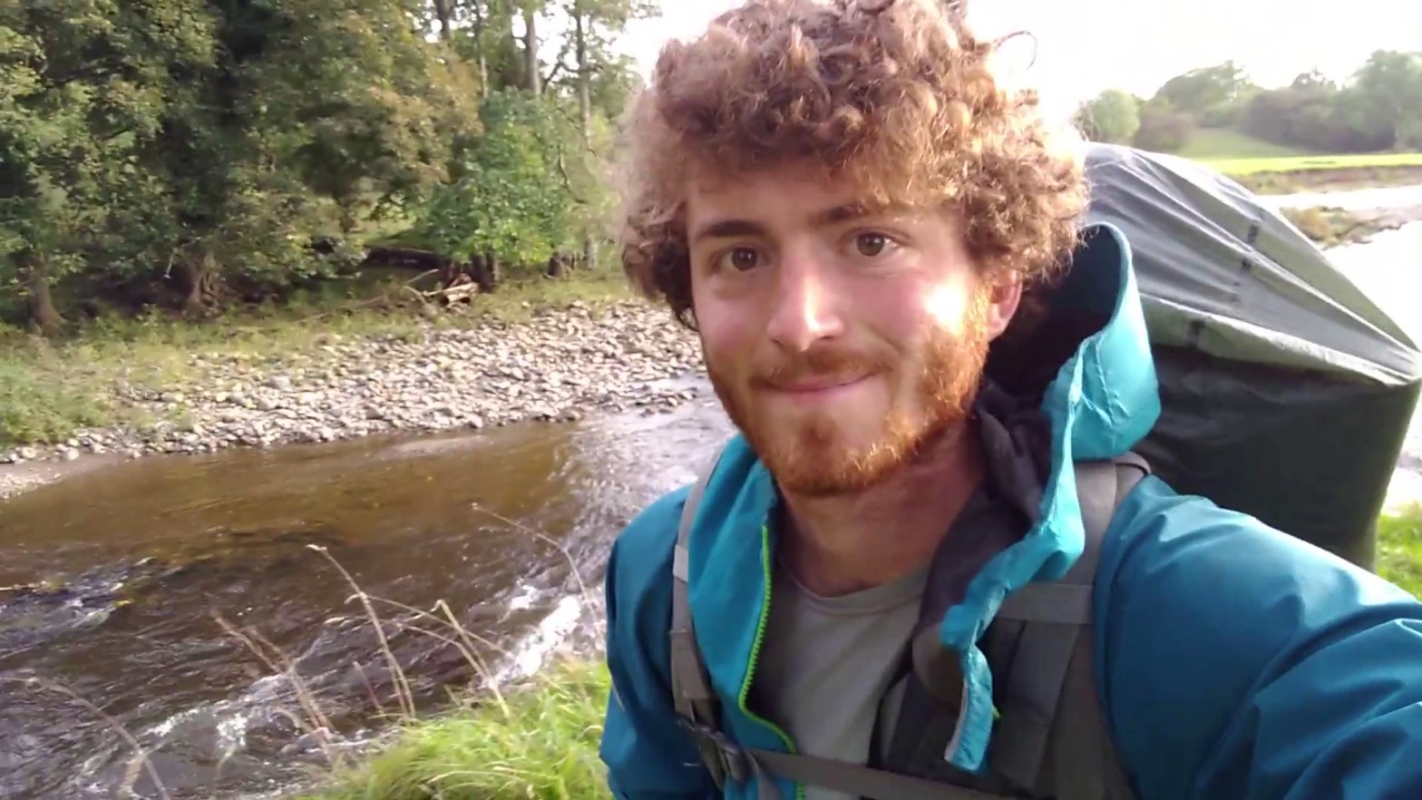
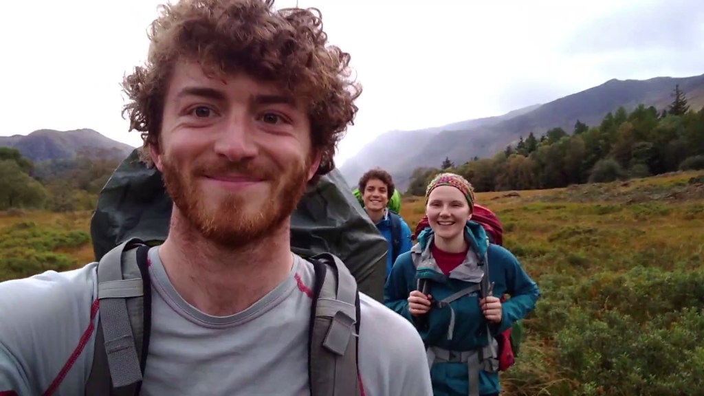
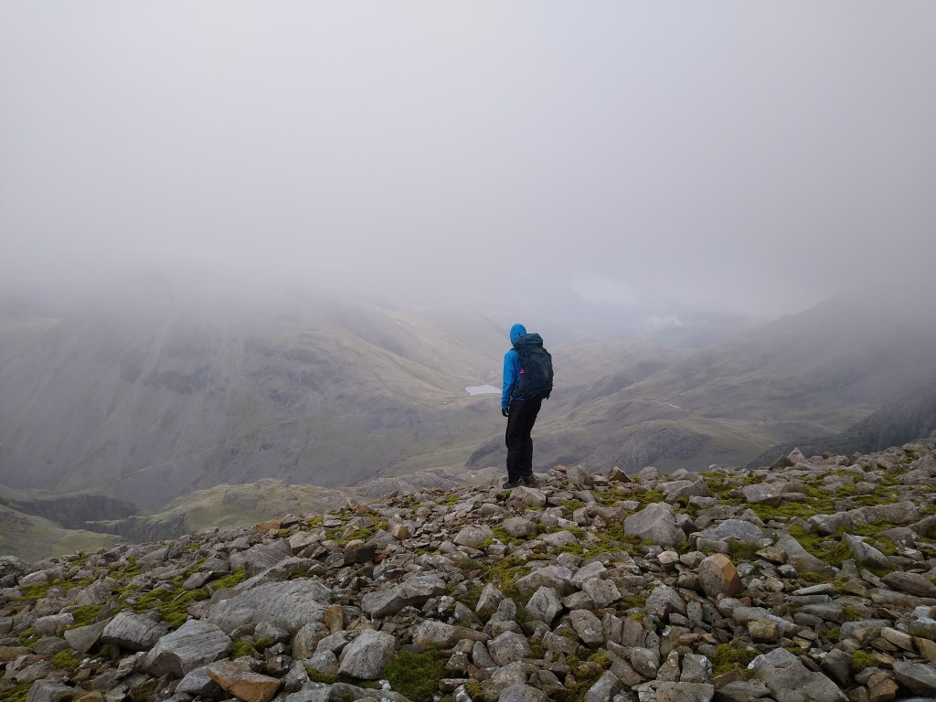
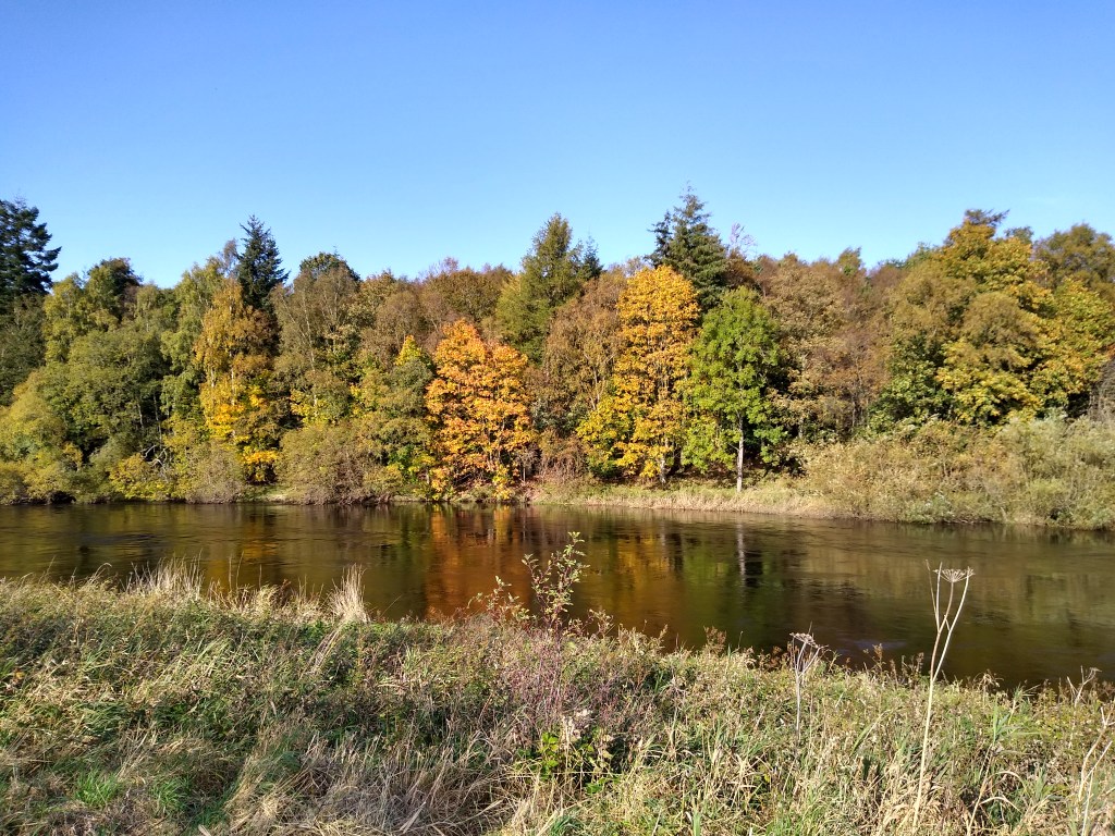
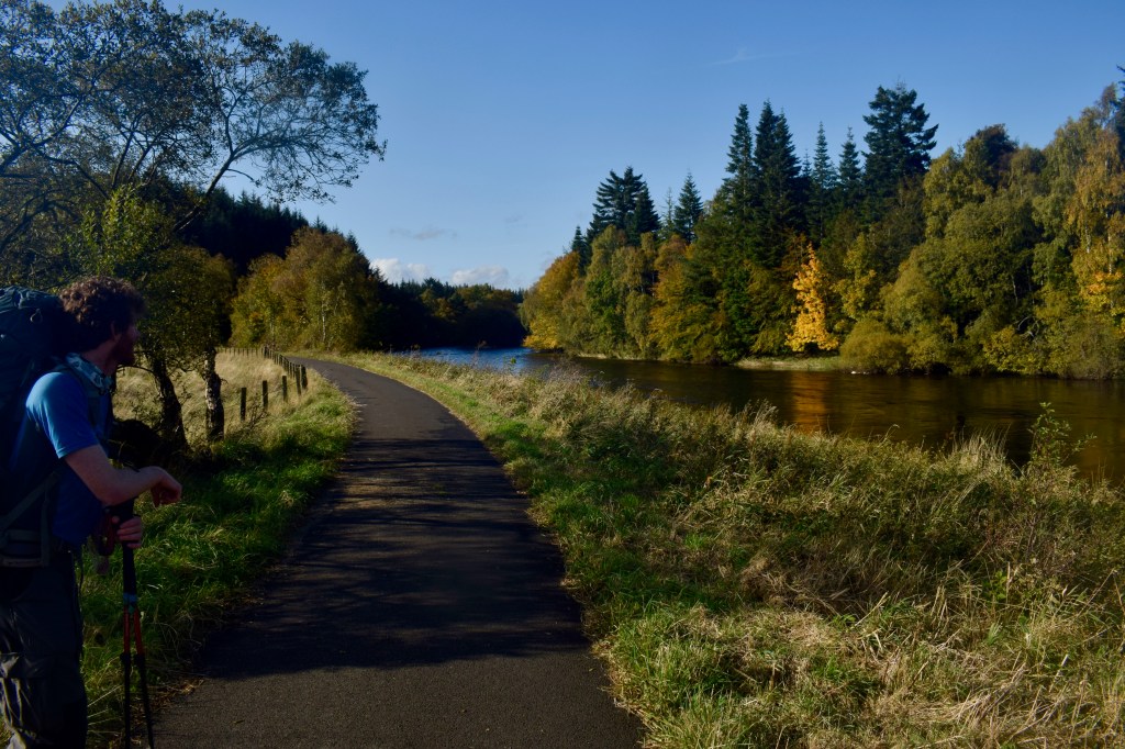
My pace quickened over the last few hundred metres to the river, and in my single-minded near-frenzy, I left Adam in my dust. I didn’t actually do anything when the river came into view, except stop and wait for him, so perhaps it was anticlimactic. The sight of that smooth water flowing gently north, and the leaves turning on the far bank, gave me a feeling of tranquillity. Adam sensed that this was a big moment for me, so he took a picture before we ambled on.

Greeted by tranquillity
Resting on my poles, enjoying a big milestone

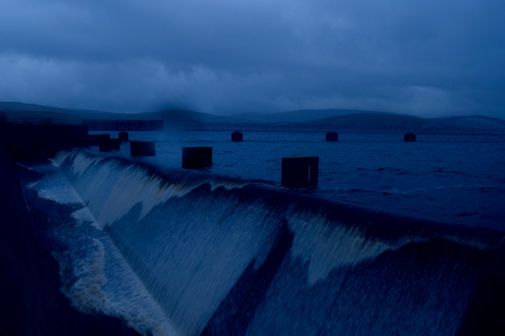
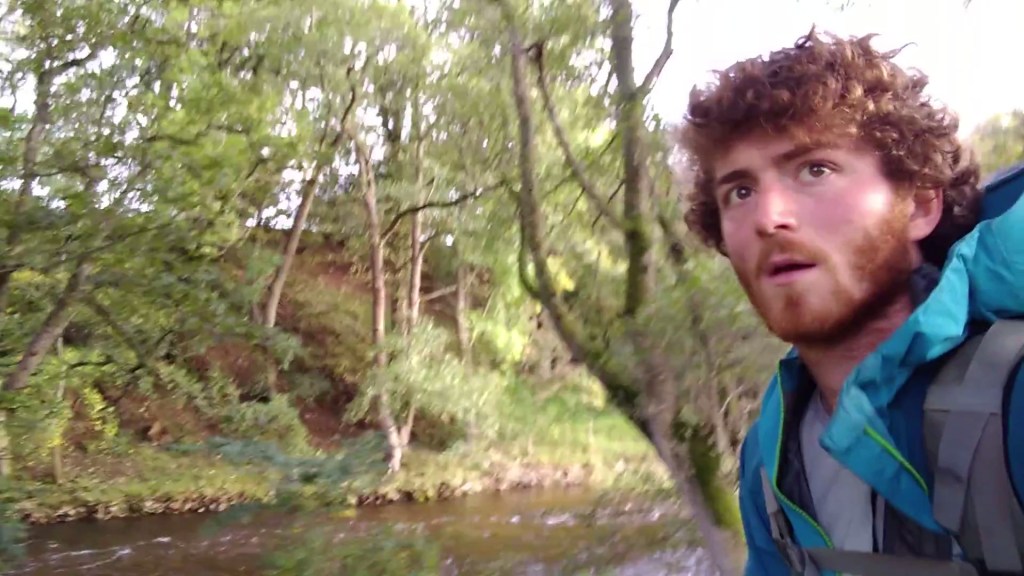
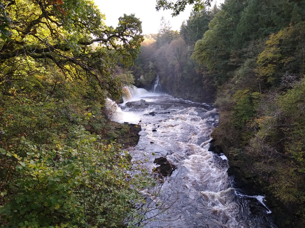
We crossed a weir and went into the shade of the oakwoods that line the banks. Then we saw the first of the falls, and had to stop to admire them. It was strange – through that pain and monotony we quite suddenly found ourselves in a place of exquisite natural beauty. It was like arriving in Rivendell. You could spend hours watching the leaping spray, the ever-shifting layers of white water, the light playing on the leaves, the fine intricacies of the river-carved rocks. You could imagine what it would feel like to run the gauntlet of the falls and rapids in a kayak, if you were more skilled and bolder than you are, plunging over the drops and feeling the power of the water around you. We found a place to sit and eat by the roar of the falls, then carried on slowly, taking it all in. Those were a charmed couple of kilometres, and gave our spirits a well-needed boost. How far it could carry us, we would see. I was desperate to get within striking distance of Glasgow by that night.

Pain starting to creep into Adam’s eyes
Unexpected beauty

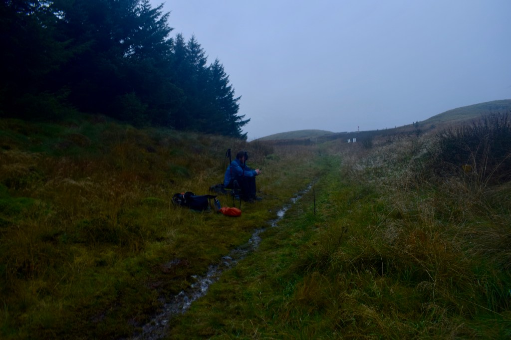
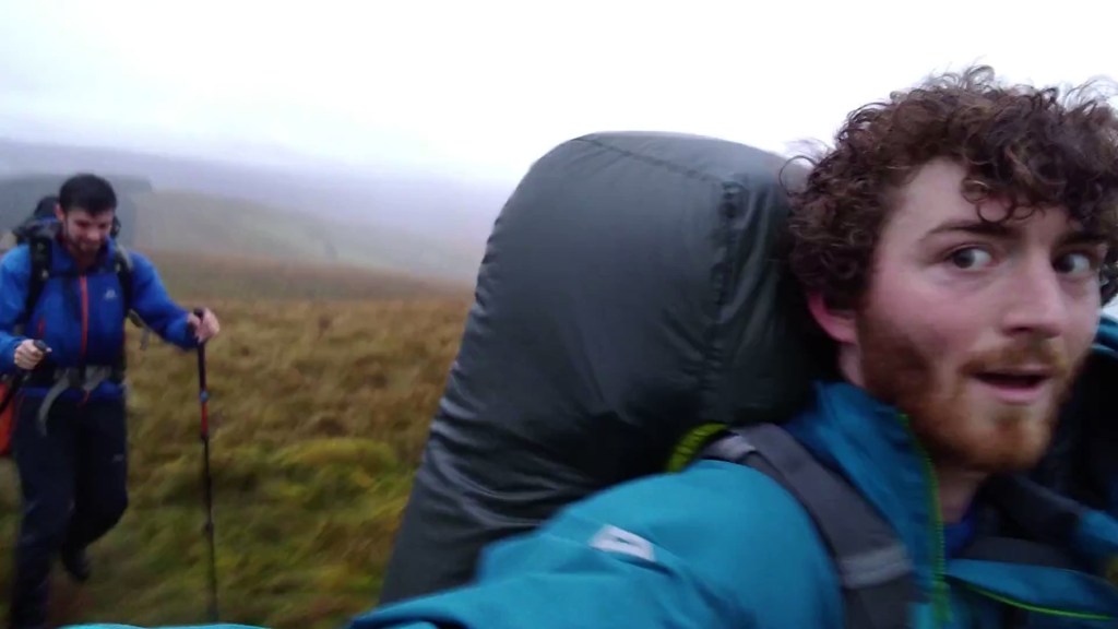
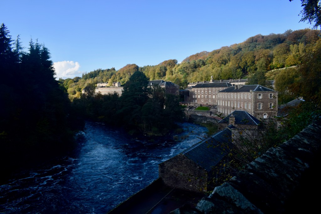
We avoided being shot by arrows in the tourist area of New Lanark (a World Heritage Site), and pressed on. We crossed the river to Kirkfieldbank, then crossed it again. Our pauses became more frequent. I started to find that a gap kept gradually opening up between Adam and me, with him slowly dropping behind. I tried to find a pace that would bring me just in front of him, wordlessly urging him onwards, but it didn’t work. When we stopped for me to fill my bottle from a small stream, he admitted that his feet were giving him a lot of trouble, and he was suffering. This wasn’t good news. We were still 44km from Glasgow, and at this rate we wouldn’t make it the next day. I didn’t want to force him through pain. We agreed that we would slow down, but walk into the night.

The old cotton mills of New Lanark

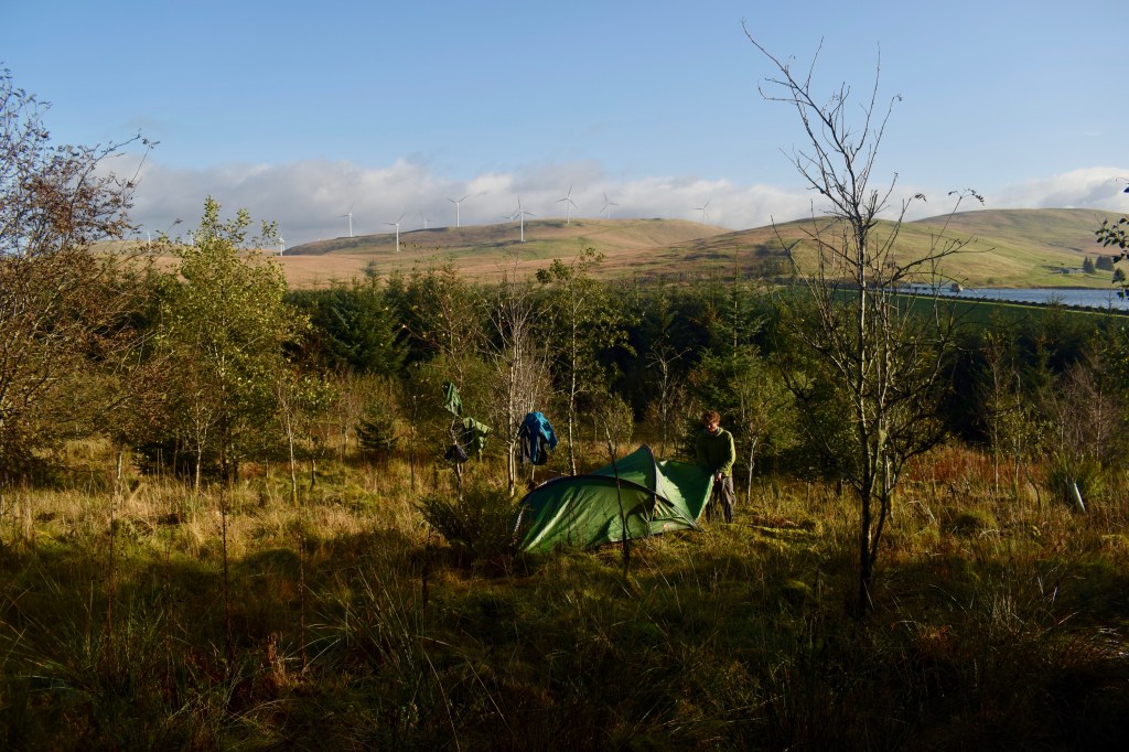
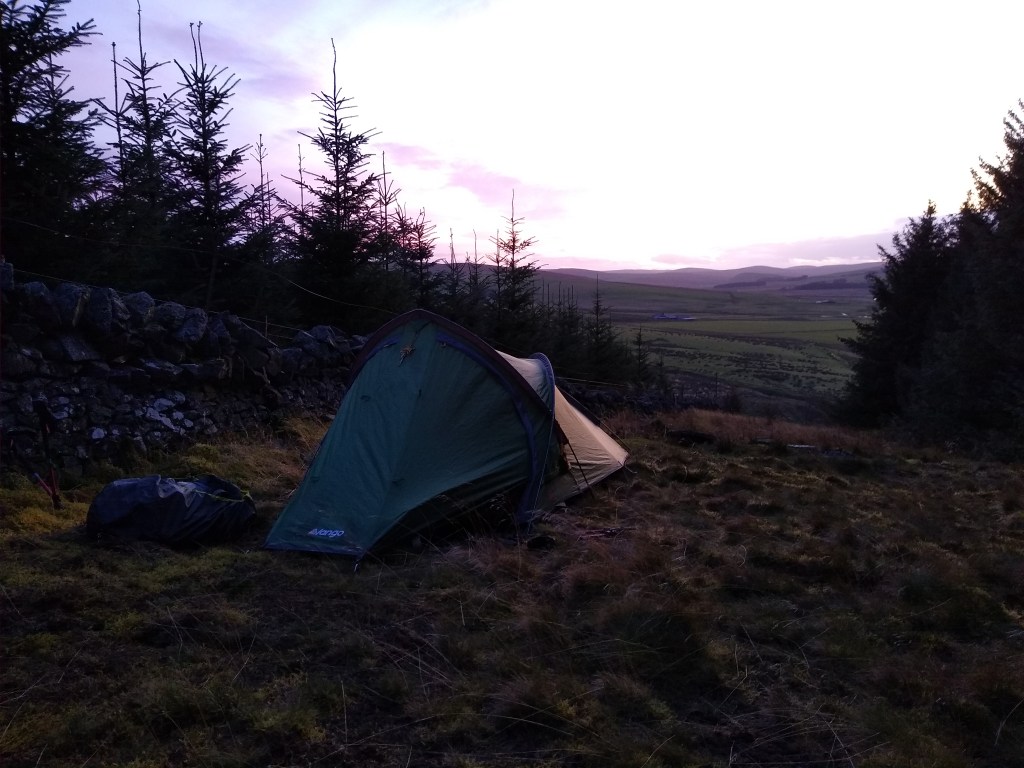
I found it tricky to hold myself back when there was so far to go, but then again, my feet were hurting too. Maybe that was just a fact of life for me at that point. Darkness fell as we made our slow way along the banks of the Clyde. After 3km, the walkway cut a corner that the river took more widely, and between the path and the water was a flat little wood where we might be able to discreetly tuck the tent away; we had reached a more densely populated area and had passed plenty of walkers along the path. Looking at the map, there probably wouldn’t be as good a campsite for another 3km. We were 41km from Glasgow, but I thought we had had enough for that day. If I had asked to go on, Adam wouldn’t have complained, but he was definitely relieved when we settled on stopping there. I said we’d see how Adam’s feet felt in the morning. We both knew they wouldn’t be good, and that was something we would have to deal with, but we tacitly ignored that. On our phones, we searched for hostels in the centre of Glasgow, and settled on one just by the river. We would get there. We had to.

Day 21: Lead Ahead

The battering of wind and rain against the thin walls of my tent meant that sleep had come fitfully, but the morning was miraculous. I emerged into glittering surroundings. The sky was clear, the sun was out, and prospects were looking up. I peeled out the dampest of my gear and began to decorate the surrounding birch saplings with it. Adam joined me in this. We had distance to cover, but thought it would be worth allowing ourselves a bit of drying time. Even the tent, once we had emptied it, got a place in the sun.

Out to dry

We first followed a track through the forest before emerging into the open, wet grassland of the Daer valley. We came across a couple of archaeological sites – a seventeenth century bastle house and a burnt mound. As I remember, there was a bit more to look at in the case of the former, though the fact that I didn’t take a picture of either implies neither was drawing in the crowds. Bastle houses were built like mini fortresses to protect the local farmers from the marauding reivers (not that the occupants would necessarily object to a spot of reiving themselves). Whereas most houses in the area would have been built of turf or clay, these had stone and mortar walls three feet thick. The burnt mound was indistinguishable from the surrounding ground but for a sign saying “BURNT MOUND”. This was a site where bronze age people heated water with hot stones, potentially for bathing or even saunas, depending on how willing you are to go along with the wild conjecture that is an archaeologist’s bread and butter.

The Daer Valley

After advancing a bit further, we encountered a strange thing. It was another backpacker, walking the other way. I was definitely surprised; I had become so used to being the only one around. We stopped for a chat. The man was drenched in sweat. “You’ve got quite a climb ahead of you,” he told us with a grin and an Eastern European accent. We looked at the high, rolling hills behind him. “Does the path go up there?” we asked. “Yeah, it’s pretty steep.”

When we’d wished each other luck, I got up my map and examined it more closely than I had previously done. When planning the route, I simply assumed that this well-used long-distance trail would be the path of least resistance through the hills, probably winding through the passes. This was not the case. The way went up onto the summits of several hills, just about maximising the possible ascent. Well ok then.

We came out into the glacially carved Dalveen pass and walked southwest along the A702 for a kilometre or so before beginning the slog up Laght Hill, 200m above the valley floor. We then immediately went down 100m to a col, then up another 220m to Comb Head and Cold Moss. We had left all trees far behind and were in a world of windswept, empty hillsides. As we climbed and could see further around us, a sense of vast emptiness took hold. The only notable feature of the landscape was the dozens and dozens of wind turbines covering the surrounding hills. Ecologically, the barrenness of the land didn’t sit well with me. I didn’t know its history, but I felt certain there should be more life and diversity here than we were seeing.

Adam coming up onto Comb Head, fleeing evil wind farms

The chill wind whipped away my excess body heat as the strain of the ascent generated it, and I found the best combination of clothes to be a thin baselayer t-shirt accompanied by gloves and a buff. It also snatched away any words from our mouths, so we pushed up the final ascent to Lowther Hill (725m) in determined silence. The path actually skirted just beneath the summit, which instead was occupied by the slightly bizarre structure of Lowther Radar Station. We had first spotted this from far off, sitting on top of the hill, looking exactly like a giant golf ball, teed up and ready for a titan to take a swing at. The white sphere is actually just there to protect the inner machinery and instrumentation from the elements, and the purpose of the station is to monitor air traffic. This was the highest point I reached between Scafell Pike and Ben Nevis.

It was then steadily downhill for the next couple of kilometres, down to Wanlockhead, an old mining village, and Scotland’s highest, at around 410m above sea level. The name is derived from the Gaelic “Cuingealach”, meaning “the narrow pass”. This little village has a long history. The Romans were the first to exploit the lead deposits here. For centuries, lead and other minerals were mined in the summer months, with the high, inaccessible valley being abandoned in the winter. Eventually a permanent lead smelting plant and housing were established in the 17th century. The richness of the deposits led to the place becoming known as “God’s treasure house”. There was zinc, copper, silver, and gold of such high purity that it was used to make the Scottish Crown. Mining ended in the 1950s once all of God’s treasure had been carried off.

Coming down to Wanlockhead

Old mining towns sometimes have a feeling of having been left to wither away, but Wanlockhead appeared to be prospering fairly well. The Museum of Lead Mining is found in the heart of the village, and Adam and I were intrigued by the words “Beam Engine” marked on the map – to me it sounded tantalisingly steampunky. The fact that the Southern Upland Way goes through the village also helps bring in the tourists. Admittedly, when we arrived, it was very quiet. We bumped into a couple of ladies, who put a donation in my pot. We tried to check out the museum, but it was shut, so we settled on the pub instead. On the way there, we were passed by the same ladies again in their car, and one of them went and rummaged around in the back before handing me a carrier bag full of loose but individually wrapped tea biscuits. Munching on these perked me up for the next several days.

Scotland’s highest pub is a good one, and we enjoyed (predictably) chips and a drink, and recovered a bit from our march over the hills. We left the village to the north, along one of the three valleys that Wanlockhead sits at the confluence of. A couple of kilometres brought us to the next village of Leadhills, which you can work out the etymology of for yourself. It’s a credit to the self-improving attitudes of the 18th century miners that these two tiny villages have the two oldest subscription libraries in the British Isles. As we passed through the village, many windows were adorned with signs proclaiming a desire for No More Windfarms, and that we must Save The Lowther Hills. As I had thought the Lowther Hills looked like something of a wasteland in terms of biodiversity, I wasn’t completely sure what they wanted to save. Restore The Lowther Hills, or Rewild The Lowther Hills would be slogans I might find it easier to get behind.

The sun joined us as we covered several more kilometres down the valley, fairly worn out. We followed a side road that cut over the hills, thankfully at their lowest point, towards the village of Crawfordjohn. The hill to our right was covered in dense sitka plantations, and since the way ahead looked a lot more open, I thought we should keep an eye out for a sheltered spot to camp. Eventually we explored a narrow strip between the forest and a wall on a terraced hillside. The sun was sinking low and the wind was still whipping right through us, but after getting the tent up, I found that under the trees it was still, quiet, and there was a comfortable, uninterrupted, smooth carpet of needles blanketing the ground, so we sat in there to cook and eat. We enjoyed the calm as the sky outside faded from pink to grey. After facing all that ascent, we hadn’t covered quite as much distance as I had hoped, losing ground against my plan. I was always thinking of the effect this would have on the days ahead. We were 75km from Glasgow, and I hoped to get there for the night after next. It looked like there was an unpleasant experience looming in my immediate future.

Wild camp next to a plantation

Day 20: Southern Upland Wayfarers

Roads as empty as my head led me down into the valley of Annandale, barely a thought or car passing me by. Billowy clouds blustered overhead. Even the fields looked empty. The whispering of the thinning hedgerows gained a rumbling undercurrent as I eased into a parallel course with the A74(M), across the other side of the open dale. The small road on my side of the river undulated more than the roaring highway across to the left. I took my time. I would have to wait for Adam to arrive in Beattock anyway.

Adam is another of my former housemates from Bristol. We had been the two expeditions officers in the University of Bristol Expeditions Society in the same year – he had been far more organised than me. As part of that role, he had organised a glorious backpacking trip to the Lofoten Islands in Arctic Norway, that for me had started a love of all things Norwegian. He was also the first person I climbed outside with for the first time after my accident, two years later, and had been reassuringly patient as I struggled to control my panic and intrusive visions of myself falling again, on what should have been easy routes. He had set out that morning to drive up from his home in Sheffield. I had asked him to bring me fruit.

I turned to cross over the river, under the railway and motorway, and joined a cycle route into Beattock. As you might be able to tell, the 11km from the morning’s starting point were fairly unmemorable. I still had a while to wait, so I sat on a bench and read. By the time Adam arrived, we were both ready for lunch, so we wriggled with our big backpacks into the empty pub, and ordered some chips. I was pleased to find that Adam had come well stocked with snacks. After finishing and asking the lady at the bar to fill up our water bags, we found our way to a signpost marking where we could join the Southern Upland Way.

The Southern Upland Way is the longest of Scotland’s Great Trails, snaking across the widest part of the south from the Atlantic coast to the North Sea, over the top of the rolling Southern Uplands. Althought its overall direction is almost perpendicular to the way I was going, a meander in the trail meant that there was a section running roughly northwest from Beattock to the village of Wanlockhead, and in the absence of just about any other footpaths, I was eager to follow it.

The way took us up the west side of the valley, away from the farmland and into forest interrupted by clearings of heather. We went through a picnic area, but the weather was starting to turn, and we weren’t surprised not to find people there. Historically, this was reiver country. The frequent conflict between England and Scotland from the 13th to the beginning of the 17th century gave rise to a tough people who decided to make what living they could by raiding both sides of the border, using their knowledge of the hills to evade their enemies. They were seen as excellent cavalry, though they were difficult to control in an army, being mainly loyal to their own clan, and apparently seeing their fellow soldiers as potential sources of plunder, which I want to be true. The raiding began to calm down after the crowning of James I and the unification of England and Scotland, although with the way things are going, maybe they’ll be getting going again in a few years. Some border families spread and settled parts of Ireland and America, and the clan names live on. In 1969, a descendent of a reiver family by the name of Armstrong carried out possibly the most audacious raid of all, when he stole from the Moon.

A break after a wet ascent

Our feet were already squishing through the boggy ground when the rain began. Our clothes got wet from all sides as we sweated our way uphill. They were the kind of conditions that put a dampener on conversation, and Adam and I trudged with our heads bent over, watching our feet as water dripped down our brows. We went up and over Craig Hill, came down to cross a small burn, then began a steady slog of a few kilometres up to the highest point of the day. Towards the top of Mount Joe, we emerged suddenly from the forest and felt the free wind blast into us. Cresting the hill, a wide view opened up before us through the lashing rain and grey light. The two-mile long Daer Reservoir was below us. Beyond it, more hills in all directions.

We turned to walk down to a saddle, following the edge of the forest to our right. We then had our last ascent of the day, a steep 100m up to Hods Hill (561m), for which we were helped along by the gale behind us pushing us onward. On the summit, though, we turned again to take the wind on the broadside. We leaned into it as we walked through a torrent of cloud and sideways rain. There were no features discernible but a lonely line of fence posts. No longer struggling with the ascent, I was able to revel in the meteorological dramatics. After all, I was already wet. Adam had hung back to get out his camera, and I was glad I would be able to show people the conditions we were marching through. In fact, I was glad of the conditions in general – I would have felt a little let down if the whole walk had failed to throw something like this at me.

Yet another blurry still from a video, because I didn’t plan how I was going to document any of this. Snatched in a moment when the rain eased

The amount of light managing to fight its way through the thick cloud was diminishing as we descended a long spur towards the reservoir’s dam. As we approached, we could hear a great rush of waves. We arrived at the point where countless gallons of water are allowed to slosh out of the reservoir into a channel running under the bridge we were standing on. We watched it for a wile before striking along the dead straight line of the dam itself, the wide reservoir to our left, and an uncannily steep, grassy slope dropping away to our right. There was something deceptive about the dam, and it took far longer to cross than we expected. In fact it is half a mile long, but we hadn’t got our heads round that. It got dark while we were still crossing, and we got our headtorches out.

I’m sure there is a technical name for this part of a reservoir

We decided to look for somewhere to camp on the other side. A service road curved round the base of a forested hill. To our left was a sloping area clear of trees, and we dropped our bags to examine it – it was almost entirely rutted up, and it took us a while to find anywhere that was even close to being flat enough for my tent. Everything was wet, and that awareness had become much more unpleasant once we stopped moving. Adam is about the same height as me too, and everything became a bit of a damp squeeze inside the tent. The rain didn’t stop, but eased a little, and I took the opportunity to cook as quickly as possible. I was less appreciative of the weather at this point, but it was all part of it. I resigned myself to the fact that, this being Scotland, this might be what I had to expect from now on. Oh well.

Days of Recovery, Part 1

Having slipped stories about my accident and time in hospital in amongst the walking posts, I thought it was worth devoting some full posts to the time between then and the start of my walk, to give the full picture of how my recovery went. Feel free to skip this if you’re only interested in my challenge!

After two weeks in hospital, I was taken home to Sussex in an ambulance. My parents had rearranged a downstairs room into a bedroom, which would be where I spent most of the next month or more. My situation became suddenly more real. The stay in hospital had been a new experience – even when boring, painful or scary, I had tried to be philosophical and had viewed it as seeing a new part of life’s rich and varied tapestry, but that was all over now. There was nothing enlightening about being back in the house where I grew up, dependent on my parents for everything. I felt I had practically regressed to infancy.

An occupational therapist came round to come up with ways of doing mundane, necessary things like washing and going to the loo. I felt she was more used to dealing with more frail people and her suggestions reflected that. I was quick to show that I needed no help transferring myself from my bed to my wheelchair or wheeling myself around the ground floor. I was desperate to cling fiercely to the meagre scraps of independence I had left. I had to feel that I was in some way in control. I was always incredibly stubborn growing up. I think I mellowed in this regard in my early twenties, but I still had a reserve of that stubbornness to tap into when needed. I was adamant that I was in charge of my recovery process; I would decide what I was or wasn’t capable of, what I should or shouldn’t do. In practical terms, this meant very little, but it was the mental attitude I needed to help stave off despair.

Back home, with my cat, Cloudy

My time trapped in bed or in my wheelchair seemed to drag on interminably. People who visited me remarked on how quickly I seemed to be getting better, but I didn’t feel that way at all. I was constantly frustrated. I had also never realised just how difficult being in a wheelchair is. I thought I might be able to wheel myself around outside, but a slight incline, a tiny step, or short grass all turned out to be huge barriers. Instead, when I wanted to go outside, I would get my dad to wheel me out and leave me on the lawn with a book, wrapped in layers of blankets against the November chill. I had to get outside whenever I could – I’ve never been able to sit inside watching TV all day and now was no exception. When I did watch films or shows, if I saw a character fall off something, I would flinch and get a vivid flashback. I watched the “How to Train Your Dragon” animated TV series, in which the main peril the characters face is falling out of the sky. This was maybe not the best choice.

I decided I had to use this time effectively. I read books I had been meaning to get round to, and I started learning Norwegian. I also started thinking about what I would do next. I looked for master’s degree courses that interested me, specifically ones that would allow me to do remote, exciting biological fieldwork. This was part of my determination – I would make sure that by next year, I would be able to do it.

Time lost most of its meaning, and I can’t remember how long it was before I decided I was ready to try to move around on crutches. My first steps led on to circuits around the living room table, with my parents spotting me. My legs had lost a lot of muscle and I was quite tottery. I was determined, though, and soon graduated onto circuits of the lawn, fuelled on by upbeat music in my ear.

One of the most difficult things, mentally, was the uncertainty. I had been incredibly lucky, and hadn’t suffered any nerve damage. I knew I was slowly healing, but the question of how well I would heal hung over me all the time. At the moment I felt like I had the body of a rickety, fragile old man. Your back affects everything you do, and mine wasn’t strong. So was that going to be how I felt for the rest of my life? I was sure I would walk again, but how far? Would I climb, hike, carry a backpack full of kit? Would parts of me carry a bit of pain, reminding me of that horrible fall, forever? I could only wait and try to hope, as my second life ticked away.

I began to wean myself off my powerful painkillers. I think I must have had withdrawal symptoms, because I went into a terrible mood for a week or so. The loneliness was getting to me as well. My friends in UBES, the University of Bristol Expeditions Society, were planning their winter mountaineering trip to Fort William over New Year. I asked if I could come, and it led to some extended debates among the committee. They cared about me and wanted me to be happy, but they also wanted me to get better, and probably didn’t trust that I wouldn’t be reckless. I said that I just wanted to spend time with friends again, and that my mental wellbeing was just as important as the physical. They eventually allowed me a place, on the condition that I absolutely promised to be sensible.

November turned into December, and I tried to spend a bit more time on crutches every day. A week or two into the month, following my reassurances that I didn’t need constant supervision, my parents took me back to Bristol to stay with my housemates again. This felt like a reclamation of a good chunk of independence. I could clip along to Sainsbury’s on my crutches, wearing my huge, robust orthopaedic boots, to do my food shopping. My days were brightened by the unexpected perk of having really quite a lot of people smile at me in the street, though they would also ogle my feet. I imagined this was what it would have been like being a pretty Victorian woman wearing a slightly-shorter-than-ankle-length dress.

My Bristol housemates, Adam, Duncan, Ashley, and Ollie

UBES were having their annual end-of-term black tie house party. I was overjoyed to be among so many friends again. When the dancing started, I was there on my crutches, but after a few collisions, I abandoned them and simply relied on flopping from friend to friend for support. At one point they picked me up to crowdsurf on top, which was one of those drunk ideas which is great as long as nothing goes wrong, and prompted immediate worry among the more sober partygoers. One of the people at the party was my friend Alex. He’d been on the trips to Morocco, Iceland, and Norway with me, and was a quick and surefooted walker. He’s also deaf in his left ear, like me, which makes conversation tricky because we both naturally try to shuffle round to the left of each other so we can hear. Having known him for three years, it was only after my accident that I learned he had broken his back too, falling out of a tree when he was eighteen. This was encouraging to me – I would never have been able to tell based on how active he was, so maybe I’d be fine after all.

Good friends support each other

At some late point in the party, when my back was tired, I sat down on the floor, supported by the wall, my booted legs splayed out in front of me. Alex sat next to me. We shared a drink, and I asked him what I had to expect. “You’ll be all right,” he told me. “Every once in a while, you might have a rubbish day, where your back is sore and you need to lie down, but basically you’ll be fine.” We drank to that. A bad day once in a while. That didn’t sound so bad – everyone has bad days once in a while – but to me at that time it also sounded like I might never be completely free from the effects of that brief, terrible moment.

Me and Alex in Lofoten, Norway, a few months before my accident, and a few years after his

Day 19: Changing Tack

I lay in my tent and considered my options. My aim was to reach Beattock, a village near Moffat, by the middle of the next day, in order to meet up with my friend Adam and walk along a section of the Southern Upland Way. When I had been in the route-plotting stage, I had found almost no footpaths in this part of the country. The area to my north was, however, criss-crossed with meandering tracks snaking into forestry areas and wind farms. In my desire to avoid roads and stick to wild areas where possible, I had planned to follow and link up a series of these tracks, even though they were far from direct, and went deep into rough and hilly country. Examining the route in detail now for the first time since I had plotted it, it just looked stupid. In a few places I had run out of track and simply cut through some forest to the next nearest part. What could be done with one click on a computer might mean ages of struggling through dense, scraping branches on the ground.

I went into my OS app and plotted out an alternative route. I wasn’t going to wander through the maze of tracks in Eskdalemuir forest. If I went by road northeast to Langholm, I could go along Eskdale, then pick up the Romans and Reivers Route, which would wind into Beattock, and sounded like it could be fairly scenic. This would be 58km. I plotted another route. If I went along the first bit of track I had initially planned, then took the road west after a few kilometres, I would then bend round and be able to follow a series of roads almost directly to Beattock. This would be 17km shorter and involve half as much ascent, There was nothing to suggest that it would be particularly scenic, but the choice was clear. It was time to change my approach.

I packed up with an efficiency brought on by being in a place that held very little appeal. Although I could point to where I was on a map, it didn’t feel like somewhere that was anywhere in particular, just a fairly empty bit of land between Annandale and Eskdale with no distinguishing features among the boggy hills of sheep and patches of forestry plantations. It was not a hive of activity. The Wikipedia page for Eskdale is three sentences long, one of which describes an incident in 1620 when continuous heavy snow killed all but 35 of a flock of 20,000 sheep. Maybe nothing has happened since. Maybe they haven’t got over it.

After following a road for about a kilometre, I turned onto a track that cut across a wide area of damp, hilly ground carved up haphazardly by drystone walls. It was still, and mist condensed into droplets on the curls hanging over my eyes as I walked. I passed an area marked on the map as Whaup Knowe, which is Scots for “Curlew Knoll”. I would have liked to have heard a curlew cry – it is a sound that speaks to the heart. It can reflect our feelings back onto us, its bubbling excitability lifting the heart when we are joyful but its mournful undertones coming to the fore when times are hard. It was the wrong time of year though, and the curlews were away on the coast, and the hills were muffled.

I recorded a video journal entry that simply began: “Yesterday was awful.”

After following the mostly straight track up and down for a few kilometres, I came to another road. I stopped and sat down on my bag, and consulted the map on my phone weighing up my options one last time. I lifted my head up and gazed down the road I was sitting next to, so smooth and unobstructed, so hard underfoot. I turned to look at the hills above me, and found them wanting. My mind was made up.

I followed roads for the rest of the day. Unlike the stretch I did on roads all the way back in Flintshire, there was almost no traffic, so this was a peaceful trudge. I tried to find the best surface available. My feet were in their worst state yet, so I obsessively looked for any patches made softer by a thin layer of mud or gravel to tread on. Often the grass on the verge was long and wet, which would be awkward and annoying to stamp my way through, but there was a strip about four inches wide next to the tarmac where it didn’t grow so thickly, and I followed this, one foot in front of the other like a tightrope walker. Anything that gave my feet fractional relief was worth doing.

Coming down to the village of Boreland

Surprisingly, I started to feel better. The thought of having cut out unnecessary distance and taking the most efficient route cheered me up a bit. I definitely wouldn’t have any trouble with barbed wire fences, overgrown hawthorn hedges, nettles, brambles, or disappearing paths. I passed a village where you could get horse-drawn carriage rides, and was barely tempted at all to ask them to take me onwards. The weather was classically autumnal. The wind got up and I had the odd shower, but nothing too bad.

It was on this day, though, that I had my first real discomfort in my back. As the afternoon wore on, a slight crick became gradually more painful. I shifted my pack around constantly, transferring its weight to different parts of me, but nothing helped. This was something I had been afraid of at the beginning, but I had been going well for so long that I had forgotten about the possibility that even after three years of recovery, I might be putting my back through something it would struggle with. I am sure many people are familiar with the feeling of having a crick in your back that you are desperate to get rid of. At one point the previous year, I had had that feeling constantly for an entire week of torturous discomfort, until lying in bed one night, I felt a satisfying, heavenly click, and was released. I stepped off the road into some trees, and tried to work out the kink using cat-cow poses and spinal twists. After ten or fifteen frustrating minutes of adopting various positions, I heard a click, and was thankfully able to keep going, although with some apprehension about when the discomfort might come back.

The cow is wondering why I am there, and maybe I am too

As the sky gained streaks of pink among the grey, I was up in the hills with the land rolling down to Annandale on my left. I was keeping an eye out for a possible campsite, and saw a corrugated iron shelter in what looked like an empty field. The first drops of a downpour started falling, so I nipped down to it to check it out. It was muddy and churned up by hooves – not ideal – but the rain was coming down in buckets, so I got out my stove and cooked supper while waiting it out. When it had stopped and I was finished, I discovered that just outside, an increasing number of cows had turned up to see what was using their shelter. I apologised to them and moved on, finding a better spot for the night under the branches of a conifer plantation. My decision to change tactics seemed to have been a good one. I had made good progress and was well-placed to reach Beattock and meet Adam.

Day 18: Bordering on Misery

My first task for the day was to resupply myself with enough food to last until I reached Glasgow. As I made my way through Carlisle to a big Sainsbury’s, already I could tell that my night in a relatively comfy bed hadn’t been enough for me to recover from the previous day’s pains. There was nothing to be done about it, though. I was on a tight schedule.

I did a lot more walking than I needed to around the supermarket’s aisles as I haphazardly foraged for supplies. All that food was so tempting, but the fact that I would have to carry anything I bought for up to 120 miles kept me fairly strict. In the car park, I tore out any unnecessary packaging and binned it. I then hefted my pack onto my shoulders. It was abysmally heavy. Nothing to be done about it though. I crossed the River Eden, seeing no sign of paradise, and headed north.

Having reached the end of the Cumbria Way, I was now back to following the route I had put together by looking at a digital OS map and trying to link up any sections of footpath that vaguely headed in the right direction, as part of my aim to avoid walking on roads as much as possible. I left the built-up Carlisle area at the earliest possible juncture by following along a hedgerow out to fields where ponies grazed. I went through the town of Houghton, crossed the M6, and saw my first roadsign proclaiming that this was indeed the way to SCOTLAND.

My route was not a good one. I did not flow smoothly northwards. At one point the footpath on the map took me through the middle of a farm, but on the ground there seemed to be no sign of any path at all. I more or less guessed the direction to cross a field and found a style at the far end, impassably overgrown by hawthorn. I had to retrace and try the adjacent field. Here I found a narrow gap in the hawthorn over a barbed wire fence. Muttering dark curses, I heaved my pack through the gap first, hoping that nothing would break when I let it crash to the ground, then ungainly forced myself through the tearing thorns. Why is the farmer putting me through this, I thought. I’m a good person on a noble mission.

A little further on, I joined the line of a dismantled railway. There is one of these passing near my home, and I think I had built them up in my head as a kind of walkers’ superhighway, despite the fact that this one had no actual footpath on it. So I was trespassing again. Part of this one seemed to be being used as its own long, narrow field. There were a couple of horses ahead of me who kept spooking and galloping off further away every time I approached, despite my best efforts to keep to one side and encourage them past. I was worried they might give me away. The next point of interest along the line was a huge pile of abandoned furniture and rubbish – practically the contents of an entire house. A couple of old vans added to the sketchy feel of the thing.

I suppose somebody decided this would be somebody else’s problem now

The sky was reasonably bright but with grey clouds scudding across, and it became increasingly damp underfoot as I went north. At Longtown I crossed the River Esk and turned onto my next section of footpath that started behind a truck repair centre. I looked on it with dismay. Hemmed in between a couple of high fences, the path was completely overgrown with nettles and brambles. There didn’t seem to be any other footpaths for miles around. I sighed, shortened one walking pole into an efficient beating stick, and began to fight my way through. More scratches, more wear and tear on my weary body. I then followed the river for three or so kilometres, encountering cows, mud, and pornographic magazines wet and fading among some trees. It was getting on to late afternoon. I still hadn’t reached Scotland, and I was finding it tough.

Contender for the worst-maintained path in the UK

I turned up a lane, which turned into a track though some woods. Again, I don’t think I was meant to be there, but I was now within a couple of kilometres of the border. I just had to hold out for a bit longer, then I would break through into the land of freedom, specifically in terms of its access laws. The track I was on became less clear, and then disappeared altogether, but Scotland fever was on me and I couldn’t be stopped. My bashing pole found use again as I fought through bracken and holly, under a fallen tree, over fences, around the bend of a stream, up a steep bank, and out! into a sopping wet field. It may not have been much of an improvement, but the looming threat of being shouted at by a draconian landowner was gone for good. I breathed the free air. Here I was allowed to walk and wild camp just about anywhere.

Freedom!

Though I had come out of the trees, it seemed to have got darker. Looking at my map, I found I hadn’t made good progress, due to my rubbish route planning and to rubbish routes in general. I got onto a small road that wound between farms. It was some time before I saw a sign of anyone at all actually living there. I knocked on a door in Evertown to ask the man inside if he could fill my water, then pressed on. My legs were weak. As the land faded to greys pricked with sparse lights, I turned up a muddy farm lane. At the top of a rise, I decided it was time to look for a place to camp, and I investigated a small conifer plantation. It was dark and jagged under the trees. The ground was deeply rutted and covered with rotting fallen branches. I took some time to consider whether I could sleep here, then some rooks started a ruckus overhead. The place didn’t sit right with me, though I couldn’t say why. It all felt a bit haggish. I forced myself on.

Instead of taking pictures of the scenery, I started filming my own struggle

In the gloom I had to navigate that kind of deep, liquid mud caused by day-in-day-out trampling of cattle, then a pathless slope down through a felled plantation. I made it onto a road when it was full dark. A vehicle raked a nearby field with high-powered beams. I hoped I wouldn’t get shot. I decided I had to just pick a place to camp and make the best of it. I wasn’t going to feel welcome anywhere. Wearily, I hopped over a fence that may well have been electrified, but I took great care not to find out. I was on a narrow strip of long, wet grass between the fence and another dense plantation. This would not be pleasant, but it would do. I threw up my tent and got cooking. Yesterday had been the worst day so far. Had today been worse, I wondered? I had covered a paltry 32km – less than I had hoped – and I was tired, wet, filthy, and scratched to pieces. It was a close thing, but today had indeed been worse. This wasn’t working. What was I going to do?

Day 17: The Way to Carlisle

Blustering winds shook the walls of the tent, waking me up for another day of walking. I lay there for a while. There is nothing quite like the peace of hearing the besieging weather breaking against the thin material of a sturdy little tent, knowing that it will howl and rattle, but will not touch you. Eventually, though, you have to take a guess at how cold it is going to be outside, wrap yourself up in an appropriate number of layers, and step unwillingly out.

Navigation today should be straightforward – I was following the Cumbria Way to its endpoint in Carlisle, the county town of Cumbria and the closest English city to the Scottish border. I had come out of the Lake District fells down a valley trending northwest. For the first 10km of the day, I would curve round to the northeast, skirting round the base of the northernmost group of fells, before turning north and following the Cald Beck, which became the River Caldew downstream, which would take me all the way into the middle of the city. The total distance for the day would be 37km – easily my longest yet. There was nothing for it but to get cracking.

After crossing a few fields of pasture, the way went along lanes and tracks for several kilometres, passing a few farm houses and little else. I contoured round the lower reaches of spurs, up and down, up and down. The wind continued to blast into my face. I didn’t see many people. The sudden increase in the distance I had to go threw my judgement off. I kept thinking that I must be turning north soon, but on and on I went. Maybe my rapid 15km march the night before had worn me out, too. I had less energy today, and before I reached the lane that would start to take me north, I knew I was flagging. I did the only sensible thing to do, and found a partially sheltered fold of ground, sat down, and had a snack. This improved matters slightly, but I knew it was early in the day to be needing a break. This did not bode well.

I followed a lane downhill to the charming village of Caldbeck. Had the Old Smithy Tearoom been open, it would definitely have beckoned to me, and the Oddfellows Inn seemed made for me. I was in no doubt that I was the oddest fellow around. It was not to be, though. I crossed the river on an old footbridge by the church, and passed out of the village. I came to an area of parkland on the hillside above the river. A comfortable-looking log was too tempting, and I stopped for another break. I told myself that this was fine; I could take all the time I needed and just plod on.

This is a still from a video, hence the blurriness. I don’t know why I look like I’ve seen a UFO

After that I managed to keep going for some time. The land opened up as the hills around the river gradually got lower and I walked along the margins of wide meadows. The most exciting moment for me was seeing a red-breasted merganser, a kind of advanced-looking duck with a serrated bill, cruising along the river. I passed Rose Castle as the afternoon took on a soft glow, where the bishops of Carlisle used to take refuge from marauding Scots, and presumably still would, if any modern Scots got into a marauding mood.

Afternoon light pouring under Rose Bridge

The sun was getting low when I sank to the ground to eat, in a field of relaxed sheep. It felt like I deserved to be nearly done, but there was still another 11km to go. One thing I reflected on a lot on throughout the walk, and particularly now I was aiming for a strict deadline, was that there were no shortcuts or easy ways out; no way of reducing the hardship. The hardship would end when I had been through all of it and not before. On any given day, if I gave up early, that would just mean there was more distance to go the next day, and more allotted hardship. This was my grim motivator. I always had a stick, and only occasionally could look forward to a carrot.

A couple of kilometres further on, I went through the town of Dalston, where the Cumbria Way joined with a tarmac cycle path. Several cyclists and dog walkers were out, and I became more self-conscious of how bedraggled I was. I now also knew that I would be on a hard surface for the rest of the way. By this point, my feet were hurting constantly, but on grass or gravel, it stayed at a bearable level. Surfaces made of tarmac and concrete dealt a hammering that made my morale deteriorate inexorably. As the light faded, I considered my options for the night. Before I had set off on the walk, my mum, in a fit of worrying, had said that if I ever wanted to stay in a hostel, she would pay. As I limped on, I kept an eye out for likely discreet camping spots, but the fact was that I had decided to get into Carlisle that day, and once I was there, I would be unlikely to find anything. It was time. I rang home. Mum immediately asked if I was all right. She was only too happy to book me into a Travelodge.

Knowing exactly where you are going to finish, and that there will be a bed for you, is just the thing to push you on through the pain of the last few kilometres. I moved under orange street lighting through an industrial part of Carlisle. People wandered about, having normal nights, not exhausted, not weighed down by a commitment to a bizarre journey, not looking like a vagrant. At last, the soulless lights of the Travelodge reception beckoned me in (I have not been well disposed towards Travelodge since getting in from a late-night bat survey when working as an ecologist, only to find that they had apparently given our room away, forcing me and my colleague to spend the night in his car). I gave my details to the receptionist, half in a daze, and went up to my room. I don’t normally take the lift, but I thought, “Screw it, I’ve earned it.”

I dumped my things and lay on my bed for a while. I decided I would go and get some food, but I thought I should try to do something about my smell and general presentability first. I showered and tried to pick out some cleanish clothes, I had two pairs of trousers, but both were muddy. I also noticed that I had tramped mud over the carpet and made a token effort to pick the worst of it into a bin, though I couldn’t find much will to care about it. I dug out my wallet and stumbled along to one of the two Wetherspoons that graces Carlisle’s main street, less than a hundred yards apart. It was noisy, and filled with far more people than I had become accustomed to. I had been here before, stopping for lunch while on the way to Scotland for some winter mountaineering. Those drives had seemed pretty epic, setting off in the early hours before dawn from Sussex to reach Fort William in the evening. Well, look how long it was taking this time.

After filling up on a large amount of greasy food, I returned to my room. I thought I would be able to take a huge amount of pleasure in having a bed, but in fact I just started to feel a bit sick. I was exhausted. It had been by far my toughest day yet, mainly because of the distance and the amount of hard ground I had covered. And I would have to keep going tomorrow, and the day after, and every day after that. I slept.

This was another day when I took very few pictures, so I will provide another summary of my progress since day 8. You can see how much I had to suddenly increase my pace after climbing Scafell Pike on day 15, having had several more gentle days in a row.

DayDistance(km)
931.2
1030.0
1125.5
1223.2
1312.6
1414.7 + 5km walk round Blea Tarn
1519.6
1629.9
1737.0

I have also just come across an online tool for visualising my elevation profile, so here is one covering the distance from Liverpool to Carlisle. You can see just how flat it was most of the way through Lancashire.

Day 16: The Gauntlet

We peeled our tents off the damp leaf litter, then shook the damp leaf litter off our tents. Though last night’s rain coated the woods, the sky was looking a bit brighter and more promising. Just a short way down through the trees, we came out to the campsite and youth hostel at Rosthwaite, where we popped in to read some information about the area. We then headed into Rosthwaite village and rejoined the Cumbria Way. I had followed this long-distance path for a while two days before as I made my way along Great Langdale, but instead of going over the high fell summits, it went all the way to the top of the valley and over a pass to come down into the valley of the Stonethwaite Beck, which joins the River Derwent at Rosthwaite. From here I would follow the Cumbria Way to its end point in Carlisle, just south of the Scottish border.

Wild camp in the woods

Borrowdale has a remote feel to it as, rather than gradually opening out as you might expect a valley to do, it is blocked off by the small but charismatic fell of Castle Crag, forming the Jaws of Borrowdale and leaving only a narrow course where the river runs through. While the only road in hugs the east side of the river, the Cumbria Way rises through the woods on the west. We passed three great heaps of slate, then arrived at Millican Dalton’s caves. In his thirties, Dalton abandoned his life as an insurance clerk in London, and embarked upon a life in the great outdoors. For many years he returned to these caves in the summer months, leading groups on climbing, hiking, and camping trips and calling himself the Professor of Adventure. Few people could get away with giving themselves such a moniker, but if you have the commitment to go through with living in a cave, then you can probably take whatever name you want.

A wooden boardwalk took us over some wet, tussocky ground to the shores of Derwent Water. This is my favourite of the lakes, and in my opinion one of the loveliest parts of the country. We wended our way up the wooded western waterside, past little bays and boathouses at the foot of Cat Bells, and looking across to the handful of islands which give the lake its character. Simple jetties jutted invitingly into the water.

Smiley team

An unexpected discovery was the Teddy in the Window. In the window of a mossy shed was a slightly sorry-looking bear that had been lost by a child in the area and never been reclaimed. Pinned to the wall around it were two dozen or more letters from the bear’s admirers from all over the world, many describing the lovely time they had had on their holiday to Keswick and often including a photo. Apparently you only need to address a letter to “the Teddy in the Window, Keswick” and it will find its way there. Further on, we came to the “Entrust” sculpture – a giant pair of carved wooden hands placed there in 2002 to commemorate the centenary of the National Trust buying its first land in the Lakes, in the Brandlehow Estate. According to Hugo, people sometimes complain that it is not being properly looked after, being mossy and cracked in places, but in fact it was always the intention of the artist, Rosalind Rawnsley, that it should be allowed to decay and return to the soil.

We crossed the suspension bridge over the outflowing river Derwent and arrived in Keswick some time in the early afternoon, after a leisurely 14km walk. There we met up with Zoë’e parents, Steve and Caroline, who treated us to lunch at a café. I didn’t want to take advantage, but they encouraged me to eat my fill, so I did – a full veggie fry up, supplemented by excess toast, and possibly even followed by a piece of cake.

At Hugo’s urging, we then went into an outdoor shop on the high street. My tent is a Vango Mirage 200. I had spent a long time researching a couple of years before and had settled on it for its sturdy design and good value. I maintain that it is an excellent tent but the drawback was that it is not particularly light. Hugo said I should try my luck in a shop by explaining what I was doing and seeing if I could pick up a lightweight tent at a discounted price. I found one on display and lay in it. I can’t remember what model it was, but it had a single pole and whisper-thin material. I weighed a packed one in my hand and was sorely tempted. There was no doubt it would make the going easier. That said, it was expensive, and I don’t tend to buy kit without deliberating about it for far too long. The shop assistant said they could offer me a small discount. Steve didn’t want to hurry me, but their parking was about to run out. With a last wistful heft of it in my hand, I put it back. I would soldier on as I was – people buying things they don’t need is a problem in the world that I wouldn’t be contributing to that day. There would be moments when I would wish that I had.

Steve and Caroline were giving Hugo a lift to Ambleside before going back to Cheshire with Zoë. They all wished me luck. Steve grasped my hand and said, “See you on Ben Nevis in two weeks, then.” In my mind’s eye, a gauntlet thudded heavily to the ground at my feet. That had indeed been what I had (arbitrarily) planned: to do the peaks at fortnightly intervals, each one on a Saturday, but to me it had always been flexible. I hadn’t set myself a particular target date to complete the challenge by, but if I wanted to finish it together with Zoë, and I did, then I had less than thirteen days to get from Keswick to Glen Nevis.

To be clear, despite what I had planned, Scafell Pike is not halfway between the other two peaks; it is significantly nearer to Snowdon. When plotting out my route, I had assumed I would get fitter and be able to cover longer and longer distances. Now I would reap what I had sown. It was after 4pm on Sunday the 6th of October. OK then. “See you then,” I said. Game on.

(These dramatics were all in my head; Steve was just being friendly)

Illustration of relative farness

I waved to them as they drove away, then sat staring at the image of the route that was my phone’s home screen. This was something I did all the time, going over and over estimations of how well I was doing, comparing my actual progress to what I had planned. It felt like I had done a day’s walking already, but if I was going to manage this, I would have to keep going. With a grimace, I traced the path of the Cumbria Way uphill on my map, reaching nearly 500m as it passed between the Skiddaw and Blencathra massifs. I saw a campsite marked on the other side of the mountains, and decided to get to there this evening. It was 15km away. In the golden afternoon light, I set off, on my own again.

The Skiddaw massif blanketed in cloud

I crossed over the A66, which runs all the way east-west from coast to coast, and began to climb. I slanted up round the shoulder of Latrigg, and onto the side of Loughrigg Fell, a broad, featureless, heather-covered slope which faces south. The path traversed this until it rounded onto the steeper eastern face of the fell and entered a deep vale, with Blease Fell and Blencathra on the far side. I paused on the cusp and let the last rays of the westering sun wash over me. Everything ahead lay in shadow. The formation of the mountains had created the perfect metaphor to mirror my mind. I said goodbye for now to laughing and singing with friends, and entered the vale of gloom and mist.

The vale. This doesn’t quite capture how gloomy it seemed compared to the sunshine

I set myself a quick pace, pumping my walking poles and cracking the whip. I felt fit and ready for this. I pressed ever deeper, to where the valley floor rose up and opened out into a wide and empty area of heather, used for grouse shooting. I felt I must be the only person for miles, until I saw what looked like the loneliest house in the world. Skiddaw House was marked as a hostel on the map, but there was little welcoming about it as I approached in the rapidly fading light. It looked grim and grey, and was backed by straggly pines; somewhere where optimistic children would be sent to have their spirits crushed in a gothic novel. I took off my pack and leant it on the stone wall for a quick rest, then tried to see if anyone was home. I wanted to fill my bottle, but all was locked and barred. It felt like a cold place. I left.

After another couple of kilometres, I could see the end of the vale. I had thought that it was already full night, but out beyond the shadow, the sky was noticeably brighter. I could see a few lower hills but mostly a great carpet of velvety dark lower ground, with the odd few scatterings of light. The beck I had been following burst out to freedom in a waterfall and the path took me down a steep shoulder into farmland (beneath a summit point called Cockup).

Emergence

Bright eyes reflecting my head torch tracked me as I went through fields trampled by cattle. I tried not to slip at the gates where the ground was the most rutted up and wet. At last I tramped into the campsite at Kestrel Lodge, and found someone to pay. She seemed a bit surprised for me to have turned up at that time of night. “I’m walking to Scotland,” I said, by way of explanation. This didn’t seem to have any effect, and I realised my old mantra had lost its power, now that I was only a couple of days from the border, on a path that would take me most of the way there. “I’ve walked here from Wales,” I corrected myself. This didn’t appear to register either – this was clearly a hard woman to impress, but she was nice enough, and showed me where to pitch my tent and cook.

I still I still had a fair amount of food, and would be able to resupply in Carlisle, so I treated myself to a double helping, sitting wrapped up on a picnic bench in all my warm clothes, dimly illuminated by my little stove. One way or another, I had been with people I knew, whether walking with them or seeing them in the morning or evening, for over a week and a half, but that was finished now. Tomorrow it would just be me and miles of trail.

Day 15: Up and Over

A smiley face came towards me across the campsite. I had first met Zoë three years earlier, when UBES (the University of Bristol Expeditions Society) was running an introduction to climbing event in the Avon Gorge to attract members from those starting university. I was helping to run the event by showing people how to tie the rope onto their harness and then belaying them on top-rope up some easy climbs. Zoë was one of the excitable freshers that turned up. She apparently quickly liked the look of me, and when I asked the group if anyone would like me to belay them for a second go, her volunteering may not have been entirely due to the climbing.

At the UBES intro to climbing, 2016, with Jono and Emily, the president and vice president of the society

A couple of weeks later, I had my accident and disappeared from Bristol. Despite being the worst thing that ever happened to me, this had an unanticipated positive effect, in that it made me into a sympathetic yet enigmatic character to the people joining the society. The committee didn’t make a big announcement about what happened so as not to scare people, but it came out in quiet words and overhearings, which presumably led on to questions of who I was. “You’ll really like him,” one of my friends apparently told Zoë, prophetically. To be clear, I am not suggesting anyone throws themself off a cliff in order to get a girlfriend, but in this case, it may have helped.

We got to know each other when I came back to Bristol, and we started going out when I was still on crutches. She became my biggest source of happiness through a time when, though I slowly got better, I was still frustrated and uncertain about how I would end up, about whether I would ever be free from the aches and the feeling of fragility.

We embraced when she reached me, and I went over and said hi to her dad and his friend. Zoë has a bit more outdoor pedigree than me as Steve has been climbing and mountaineering most of his life, and is even qualified to aid in mountain leader assessment. I think, on the basis of also liking climbing and mountains, I basically had his approval. He had brought along Murray, a mountaineering friend of his, to tick off a few Wainwrights with.

The five of us (Hugo being the fifth) made our way along the track up Great Langdale. I suddenly realised I hadn’t filled up my water bottle and nipped into the Dungeon Ghyll hotel to ask if they could fill it up. The man on reception not only did that, but also gave me a donation upon spotting my pot.

We came abruptly to the foot of Bowfell. Its east ridge, called the Band, rises suddenly and evenly from the valley floor. The first part of our ascent was a straightforward, old-fashioned slog upwards. I find this is usually the most unpleasant part of a walk – slow, sweaty, and heavy. We soon lumped our way into the low-slung cloud cover. I couldn’t say what we were talking about, but I do remember Steve mentioning something about “southern Jessies”. He wasn’t serious of course. I’m about as southern as they come, despite my dad’s dubious claims of being Scottish, but Zoë’s northern family had never made me feel like a Jessie (or maybe they had – I have no idea what it means).

Looking towards Great End

After an indefinite period of trudging upwards, we ran out of ground and perched on the rocks at the top of Bowfell. There was no hope of seeing anything more than a few yards away, so we had a quick snack and pushed on. As we crossed the saddle towards Esk Pike, Hugo bumped into a fell-running friend. He was on a reconnaissance run for an upcoming race. I knew fell-running was intense, but now I learned that these runners are an even crazier bunch than I had thought. Apparently he was running back and forth, up and down the fells, just to try to find the most efficient route that would allow them to shave off time in a race. And doing this for fun. Hugo told him about my challenge and he was impressed and said he couldn’t do something like that. This was very nice of him to say, given that he could probably have run from there to Snowdon, turned around, and overtaken me on the way to Ben Nevis.

Approaching the summit cairn

We briefly considered ticking off Great End, but the extra fifty metres of ascent that would have involved conflicted with my commitment to efficiency. We curved round the horseshoe, over Broad Crag and down to the final col. There were more people around us as we approached the summit. Although it was a gloomy day, the rain had held off and crowds were out on the fell, though nothing like what I had had on Snowdon. If you haven’t been, the top of Scafell Pike feels like one enormous, loose cairn. Despite being summitted by countless people every year, the final approach is surprisingly treacherous underfoot, with plenty of rocks that can shift and wobble, and dump your ankle into a sharp hole. We reached the summit cairn and waited for our turn to pose on top of it, with Steve and Hugo loudly saying things along the lines of “Walked all the way from Snowdon, eh? Nice going!” then looking round to see if anyone reacted. Steve produced some celebratory whiskey, which we all knocked back a sip of.

The summit team: Hugo, me, Zoë, Steve, and Murray

From there, Steve and Murray went back the way we had come, though I think they did summit Great End, and Hugo, Zoë, and I carried on down the northwest ridge towards Lingmell. A short way below the summit, we ran into another charity team, a group of nurses doing the five peaks – the British mainland ones plus the highest peaks in Northern Ireland and the Republic. They fussed warmly around me and all asked about my challenge at once so that I couldn’t keep up with who was saying what. They gave me a special donation of a piece of home-made fruitcake, wrapped up for me to eat later. I felt like a chick being tended to by a whole team of mother hens. We turned right along Corridor Route and passed the great scar of Piers Gill carving its way down the mountainside. Around there, we met and had a chat with the Southampton University Hillwalking Club, who later allowed me to come and give a lecture about the adventure.

Hugo Looking towards Styhead Tarn
Piers Gill

Down we went, past Styhead Tarn, towards Borrowdale. Hugo was telling us about his work building paths. I felt like he was revealing hidden secrets that the public weren’t supposed to know. He pointed out rocks that had been laid not for people to tread on, but instead to subconsciously guide them back onto the path, to prevent erosion around it. I was also shocked to learn how recently some of the paths were laid – within the last ten or fifteen years. They feel ancient, probably because of their simplicity. They don’t rely on modern technology (apart from possibly moving the rocks there in the first place); it’s just Hugo and three other rangers working on the fellside, digging holes and hefting big rocks.

Stockley Bridge – a 300-year old slate bridge built for packhorses to cross Grains Gill

We reached the valley floor and the tiny hamlet of Seathwaite (Old Norse again, from “sef” – sedges, and “thveit” – clearing). Having for most of its history been hidden away at the utmost end of a remote valley under the shadow of the high fells, the hamlet now sees a huge amount of pedestrian traffic. “Great days on the fells begin and end here,” wrote Wainwright. We used the public loos, and carried on down the dale. Hugo was becoming more like a tour guide by the minute, and took us to see the Borrowdale Yews, a stand of three trees over 1,500 years old. Yews are one of only three conifer species native to the UK, the others being juniper and Scots pine. They are perfect folklore trees, old as the hills, deadly poisonous, growing twistedly into dark and haunting forms, full of crevices and mystery. To look upon an ancient yew is to learn the true meaning of “gnarled”.

We passed through Seatoller and reached Johnny’s Wood at dusk, where we searched around until we found a couple of flattish spots among the fallen branches and dead leaves in which to place our tents. We were only a few hundred metres from a youth hostel, where we could have gone for a drink and potentially extra company, but instead we stayed in the wood. We cooked our supper on our little camp stoves, and then sang into the night. We sat on the damp earth, with the hoods of our waterproof coats pulled up against the smattering of bright rain illuminated by our torches. Hugo and I showed off our covers of “The Grey Funnel Line” and “Santiana” that we had polished from our tipsy rendition the night before. Hugo taught us to sing “The Parting Glass” in a three-part harmony. Zoë and I taught him a short but beautiful round I don’t know the name of, which I learned from a friend while doing field research in the forests of Borneo, who had in turn learned it from American folk circles, where the story goes that it was originally written by a father for his comatose daughter. I find it amazing how that man’s beautiful, sad expression of love has gone around the world, voice to voice, heart to heart. It seems slightly wrong to write it down, but it goes:

I have been waiting all the day long to see the stars in your eyes.

My love, come dance with me now. See how the evening flies!

And as you sleep, my dear, know that I am near to hold you when you arise.

Those couple of hours together in our bright little circle were intensely happy, and stood out not just as the best evening of the journey, but as a perfect moment. A moment to crystallise and keep, and to look back on with a smile for years to come.

Singing by torchlight

Day 14: Blea Tarn and the Sticklebarn

I must have been feeling great, because I decided to go up an extra hill. To approach Scafell Pike from Ambleside, the most straightforward route is to saunter along the glacial valley of Great Langdale. On Hugo’s recommendation, however, I took a detour up and over Loughrigg Fell, the 335m sentinel overlooking the town and the entrance to the dale. Hugo would be joining me that afternoon at the Great Langdale campsite after running some errands, so off I went on my own, up into the clouds.

The upper reaches of Loughrigg Fell turned out to be a misty mess of mire, moss, tarns, and knolls. The cloud pressed in close, limiting and transforming, showing then hiding weird looming shapes – weird in the old sense, like Shakespeare’s witches, or Pratchett’s, if you prefer life to be less tragic. It felt like beyond my vision was nothing but impenetrable cloud and I created my own moving island of reality, illuminated by sight. I would have struggled to navigate my way to the summit through the maze of earth and water without the GPS on my phone. I took a bad selfie at the trig point and carried on over until suddenly I dropped under the roof of cloud and saw the open space below. A beautiful, mirror-like lake with a wooded island in the middle told me that this was the wrong valley; I was looking at Grasmere. I had to cut across, slanting uphill and beating bracken out of my way, to get back in the right direction. At last I hopped over a drystone wall onto the road that created a pass between the two dales.

I sometimes look like I learned how to smile by reading an instructional pamphlet

I came down through the High Close arboretum to the village of Elterwater. Crossing the Great Langdale Beck, I joined a shady footpath where a man was bent over, photographing a fungus. Now, as a birder, it is completely normal to go up to any other birder and ask them what they’ve seen, and I like to take any opportunity to learn about nature from an enthusiast, so I asked what he was looking at. He seemed quite taken aback, and said, “mushrooms”. I asked what kind, and when he realised I was actually taking an interest, his face lit up. Perhaps fungus-lovers aren’t as mainstream and cool as us swaggering bird jocks, and don’t anticipate that passers by might engage with them. We had a nice chat; apparently he and his wife go on mushroom-hunting trips. I am afraid I can’t remember what species he mentioned were there, but it was a wholesome experience nonetheless.

Woops, wrong valley

I continued along the valley floor, until I found a rock where I could sit and admire the Langdale Pikes. This area is a microcosm of many things that are fantastic about the Lakes. The pikes are eye-catching craggy summits that were the most distinctive part of the sunset horizon view I had enjoyed two nights before. Below them is Stickle Tarn, which I have dipped into when snow covered the ground before, and from which a beck leaps all the way down Stickle Ghyll. Over from that is the slightly gloomier Dungeon Ghyll, and the brilliantly named waterfall Dungeon Ghyll Force. It is no surprise that Wainwright and the Lakes poets before him found inspiration here. Looking along the valley, I could see the smooth shoulder of Bowfell climbing into the clouds. That was my route up onto the horseshoe where the highest summits were to be found.

Looking up Great Langdale towards Bowfell and Crinkle Crags

At the foot of Stickle Ghyll, and indeed, powered by the flow of its water, is the Sticklebarn, a well-known National Trust-owned pub. A ghyll or gill, by the way, is a ravine or gully, down which a beck (stream) usually flows. These words come from Old Norse. I recently finished The Adventure of English by Melvin Bragg, and I have to stop myself from getting too excited and turning this into an etymology blog. The Norse influence from over a thousand years ago still runs strong in Cumbrian place names and dialect words. The words feel blunt, earthy, as if drawn from the land itself, in contrast with the touch of airiness and flamboyance of the French words brought by the Normans, which became the language of aristocrats and those aspiring to sophistication.

I stopped at the pub and ordered some food. It was early afternoon and the campsite was just a short way along the road. I sat and read. The arrival of a group of rowdy nuns disturbed the peace somewhat. My sharp eyes spotted some beards among them, leading me to suspect that they might not be real nuns. Eventually Hugo turned up, and we headed over to set ourselves up at the campsite. He was all for negotiating the price down on my behalf; as the campsite was NT-owned too, and as he was an NT ranger, his own camping spot was free. I can’t remember if he was actually successful, but if he wasn’t, it was not for lack of trying.

After pitching our tents, we went for a walk up the south side of the valley, to Blea Tarn. Since moving here, Hugo seemed to have amassed a huge cache of local knowledge and history. He told me all about the disputes and rivalries between the farmers of Langdale. Blea Tarn (tarn is another word of Norse origin) lies in a hanging valley between Great Langdale and Little Langdale, carved out by a glacier in the last ice age. The sediment at the bottom of the tarn has sat undisturbed since the ice melted. We walked round into the woods on the western shore. Hugo went for a swim while I sat against a tree and played reels on my whistle. On the far shore, he showed me a stand of aspens, each leaf trembling like a heart about to fall in love.

Blea Tarn in its hanging valley

We went back to the Sticklebarn for the evening. We thought there would be board games we could play, but the best we found was a 10×10 chequered board and a mixed assortment of pieces from two incomplete chess sets. Undeterred, we lined them up and decided on the house rule that bishops and castles from the smaller set could only move up to three spaces. Hugo was white; he had a full complement of pawns plus two mini castles and a mini bishop, but was missing a normal bishop. I had only three pawns and one mini castle, but all the other normal pieces. It worked surprisingly well and we had a good game, with my lack of pawns forcing me to go on the offensive from the start. Maybe I only thought it was good because I won, though.

Sticklebarn chess

Shortly after checkmate, a folk duo launched into lively music in the next room, so we got another drink and went to sit and listen. They were called the Drystones, and they were fantastic. I tapped my foot along with several guitar and violin pieces. Then the violinist handed his instrument over to the other and got out a long, silvery tube – a low D whistle. They began a slower piece, one full of chirpy ornamentation but with serene lingering over the airy but resonant notes of the whistle. Had it been in a minor key, it would have been haunting, but instead it was optimistic, like the warm buzz of bees over a summer meadow, or a fresh breeze filling a sail on a playful sea. I fell in love with the low whistle, and have since got a cheap one of my own to try to master. Hugo and I both bought a CD of the band’s music.

As we tottered back to our campsite in the dark, we sang. It turned out Hugo knew some of the same songs of the sea as I did, and was able to harmonise around me. I went to bed excited for the next day. Not only would I be knocking off the second peak, but I was going to be joined by my girlfriend, Zoë, her dad, Steve, and her dad’s mate, Murray. A proper team to take me up and over the highest mountain in England.